
The first day of our December walk was to be spiced up by its coincidence with the “meaningful vote”. On our way down to Mothecombe we discovered that the vote had been pulled so we were going to be denied this excitement. In the event there was another rather different meaningful vote the following evening. At the end of the 48 hours we all seemed to be back where we started – staring at the same brick wall. And the Prime Minister, with her now legendary persistence, was still attacking the wall with a toothbrush. It hadn’t worked before and it looked unlikely to work now, but everyone admired her spirit.
While Theresa May confronted her brick wall we were making better progress in South Devon. We set off across the beach at Mothecombe with its tiny bathing house and then up onto the brow above the sea.
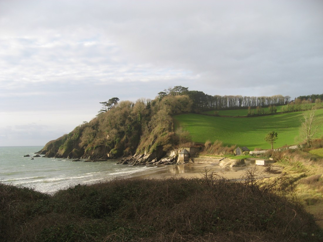
Here the topography was strikingly different with low hills running down into the sea without any distinct cliff.

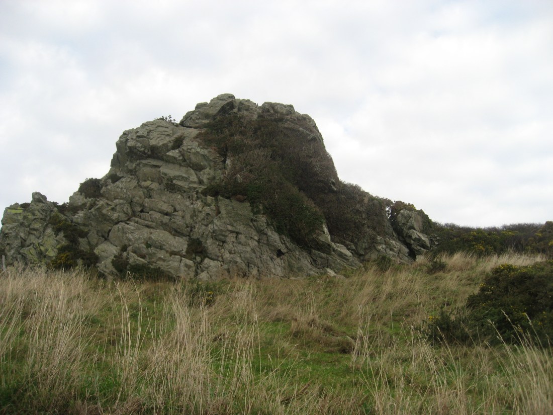
The walking was easy with the strong south-easterly wind blowing us onward rather than slowing us. The ground was remarkably dry given the amount of recent rain. We were soon at St Anchorite Rock which was formerly the home of a hermit rather than a saint, but fairly bleak either way.
The landscape looked muted and brown except for the gorse which was flowering strongly.

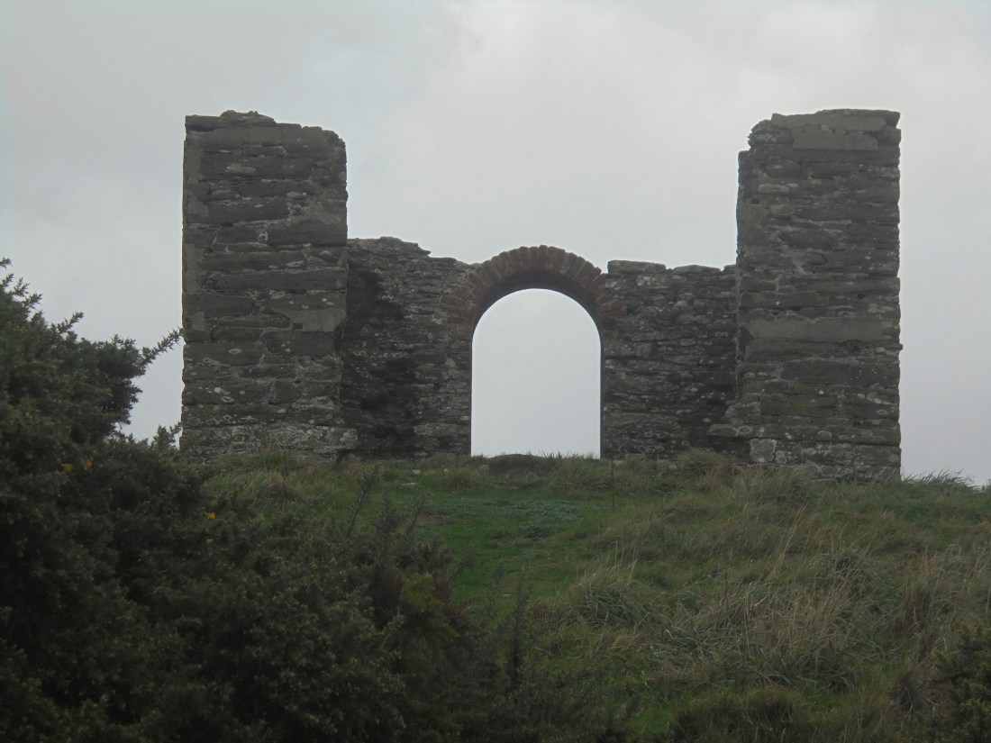
The gentle path had, in Richard’s words, switchbacks rather than hills. This complacency was savagely punished by the climb up to Beacon Hill which, in his next comment just a few minutes later, Richard described as being as steep as anything we have done so far. Hmm – yes. After a quick coffee pause we were off again passing the ruined tea house. There are a number of stories about it: originally described as a pleasure house it is suggested that Queen Victoria once had tea here. As this is on the authority of an unnamed local taxi driver we don’t think it passes the strict editorial code of this blog – fake or unverified news.
Further on we found a very evocative natural installation, a product of wind, weather and decay. It was a natural phenomenon but if an artist had put a plaque in front of it entitled “HM Government 2018” it would surely have been a leading Turner Prize contender.

The birds were keeping to themselves so it was a pleasure for Martin to see a goldcrest above St Peter’s Church. He would have preferred it to be a yellow browed warbler which is much rarer, but after wrestling with his conscience decided it was a goldcrest. Not long after this we got to the National Trust sign for Stoke Point. Our forensic calculations suggested this was our 200 mile marker so there were lots of smiles in celebration.

From here on we were on a wide green path which was undoubtedly the easiest and most comfortable walking so far. It felt almost like a built road.

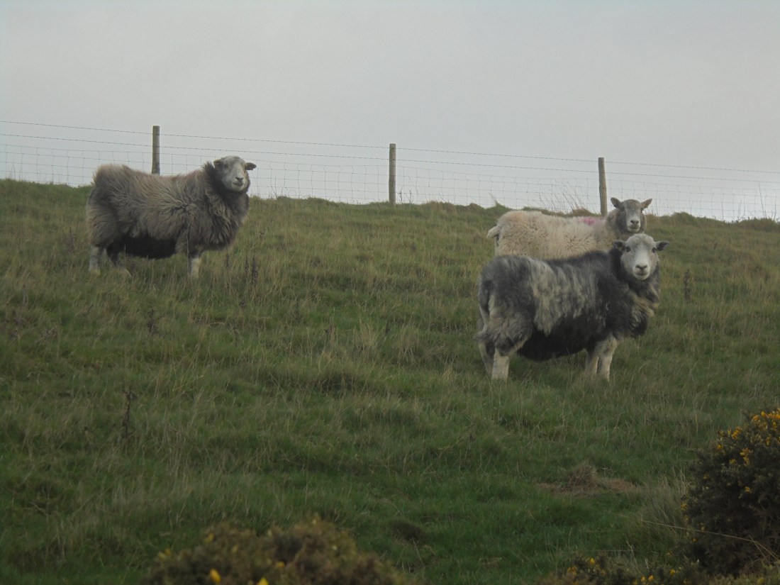
As we ambled along Martin had a chat with a small flock of Herdwicks. There were a lot of sheep along this stretch. Some of them combined shelter with feeding, nestling in the gorse to keep out of the wind and nibbling away at it at the same time.

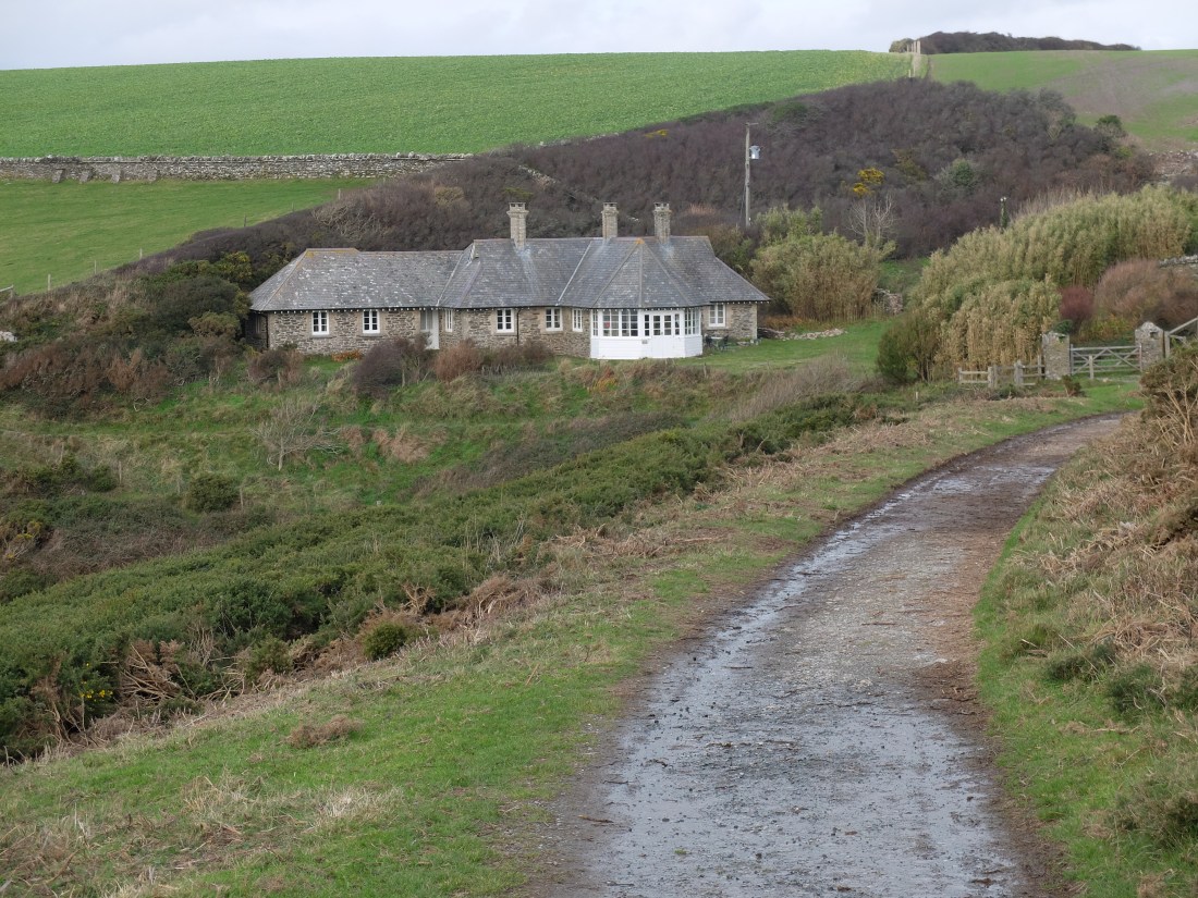
Continuing along our wide green path we looked at the notes for this section of the path. The reason for the broad path was obvious once proper research was done. It was part of a nine mile carriage drive built by Lord Revelstoke, the ennobled Edward Baring, to entertain guests at his Membland Hall near Noss Mayo. This was conspicuous consumption nineteenth century style. Half way round the carriage drive is Warren Cottage built to allow the guests to step down and enjoy a refreshing lunch. We wondered whether young Baring sons ever asked the coachman to take them there for a secluded moment with their current fancies. It’s not on the record.
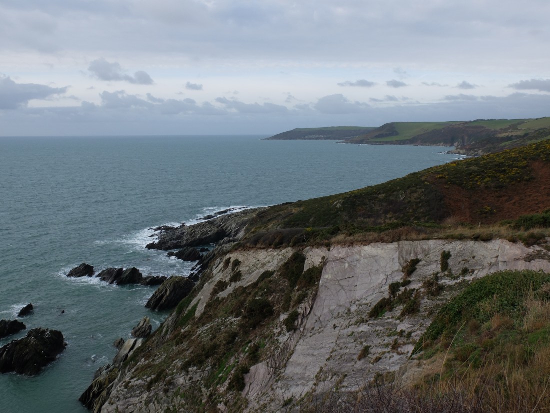
Ten minutes later we passed the first walker we had met that day. This is unusual, four hours without seeing a soul. But a December day with a strong south easterly blasting the coast is not everyone’s idea of fun. By the middle of the afternoon we were turning in to the estuary at Newton Ferrers. The estuary is well hidden and hard to spot from the South. The Mewstone is a clear marker to the West however.

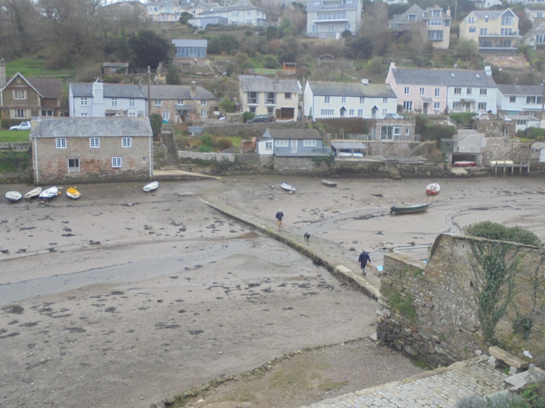
Much of the path along the estuary was in woodland. The secluded estuary with its creeks and houses close to the water’s edge is a very attractive spot. We passed the seasonal ferry route which is asleep in December.

Getting to Newton Creek where our car was parked, Martin noticed a causeway across the creek for passage at low water. In a moment of almost military precision two walkers, each with a black Labrador, approached from either end of the causeway. Was this an ancient ritual or just a daily routine?
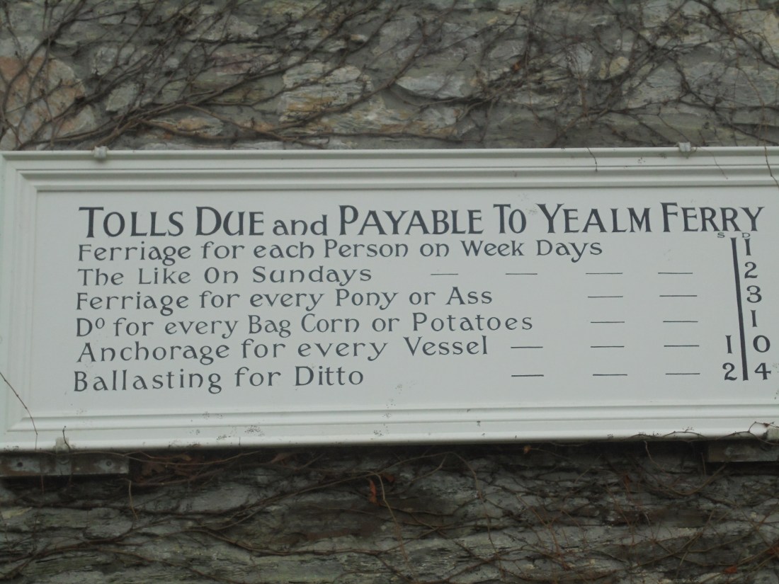
Our nine mile walk was completed at an average of 1.8mph, rather better than our normal 1.66. The combination of the cold, a tailwind and Lord Revelstoke’s carriage drive must have helped. After a perusal of the ferry fares we were off to West Alvington for our third stay with Kathryn and our last visit to the Ring of Bells.
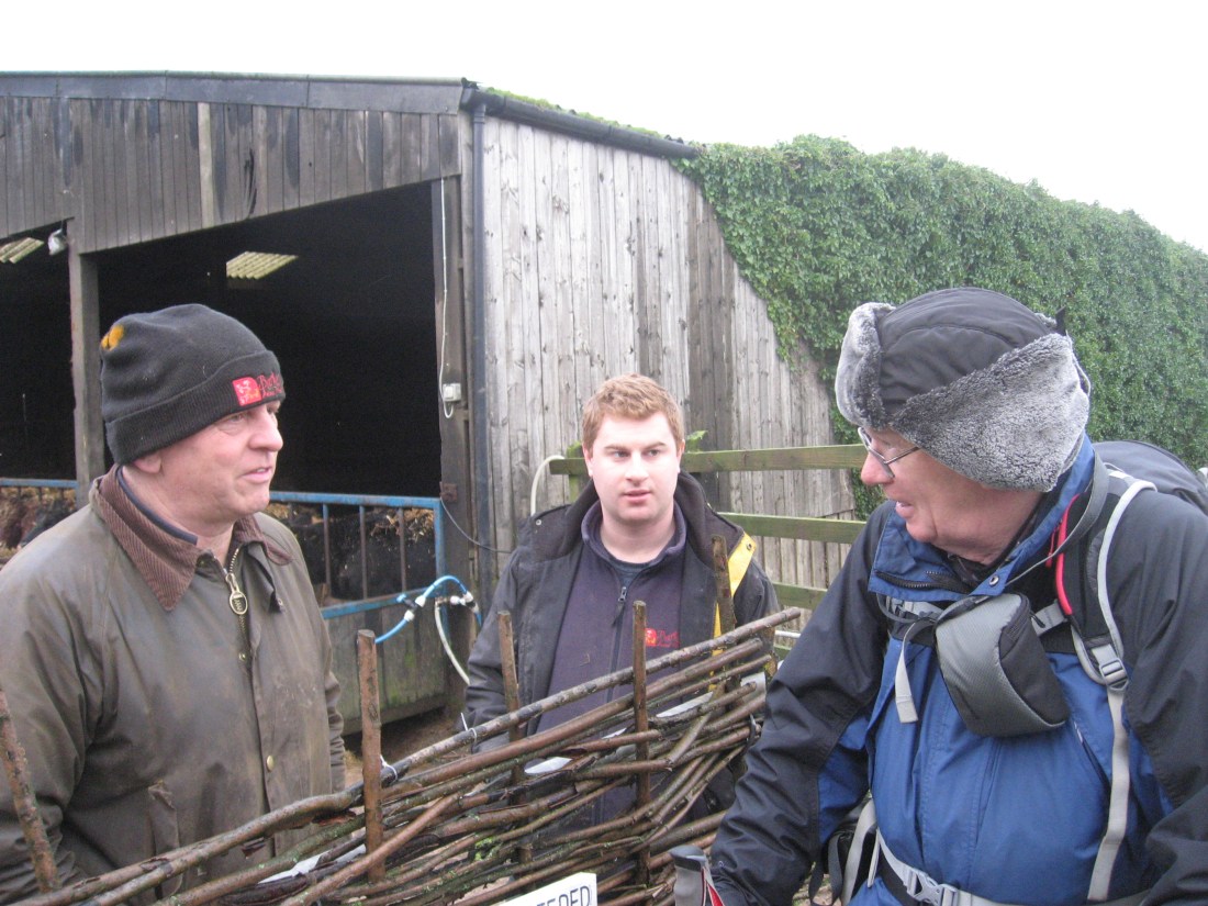
On our second day the objective was to get to the end of the path in South Devon, so that we had a clear Cornish start to 2019. Reinforced with Kathryn’s cooked breakfast we were ready for the challenge. On the way to the path we had a diversion to New Barton Farm which combines a farm with an attractive and secluded wedding venue – http://www.newbartonbarns.co.uk
Dugald’s farming nose soon picked up sweet smelling silage being enjoyed by some young beef animals.

This quickly led to a farming conversation with Tim and James, enhanced by the fact that Tim originally came from Somerset.
Below the farm was an old decoy pond with a lot of ducks enjoying it. The sheep followed Richard as we walked to the path.

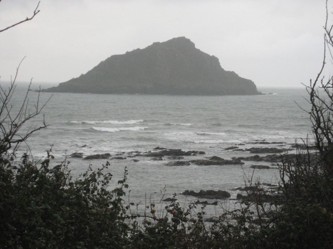
The wind of the previous day had passed and it was much warmer. But the warm drizzle quickly turned into serious rain. It made the Mewstone look particularly bleak. Pity therefore exiles who have lived on the stone: first a local man sent there in 1744 as punishment for a minor crime; and later the unfortunate Samuel Wakeham, exiled with his family in the early 1800s, a penalty negotiated instead of deportation to Australia. He stayed for many years.
In 1834 Sam advertised boat trips to the Mewstone in these terms:
“If any genteciman what likes a wark, he can wark to the shoar at Wembury, and if they holds up there white pockethanchecuffs for a signal, an ile cum off in me bote and fetch them to the island for two pence appease.”
On a wet December day in 2018 this magic no longer seemed to work.

By the time we got to Heybrook Bay the rain had abated. Not long after we could see Plymouth Sound opening up and make out the end of Royal William Yard, our destination for the afternoon. It all looked very grey.
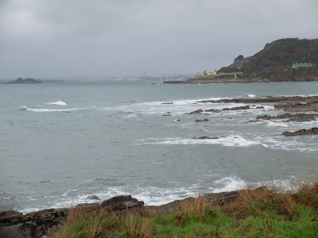
But the sun plays great tricks, one moment lighting up the view, the next plunging it back to grey again.
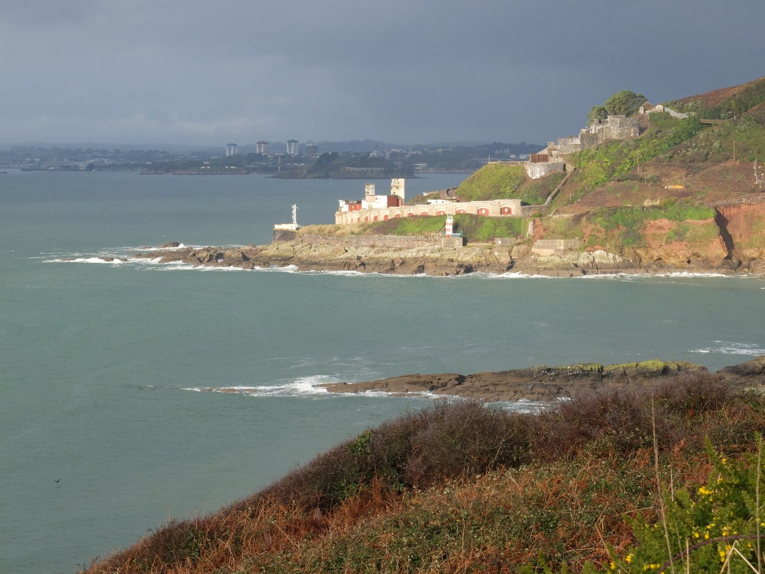

Whatever the aspect this is a view that must have lifted the hearts of tens of thousands of sailors as they finally came home. Richard remarked that Plymouth is only understandable when viewed from the sea. As we skirted round the Eastern side of the Sound the fortifications built up over five hundred years unfolded.
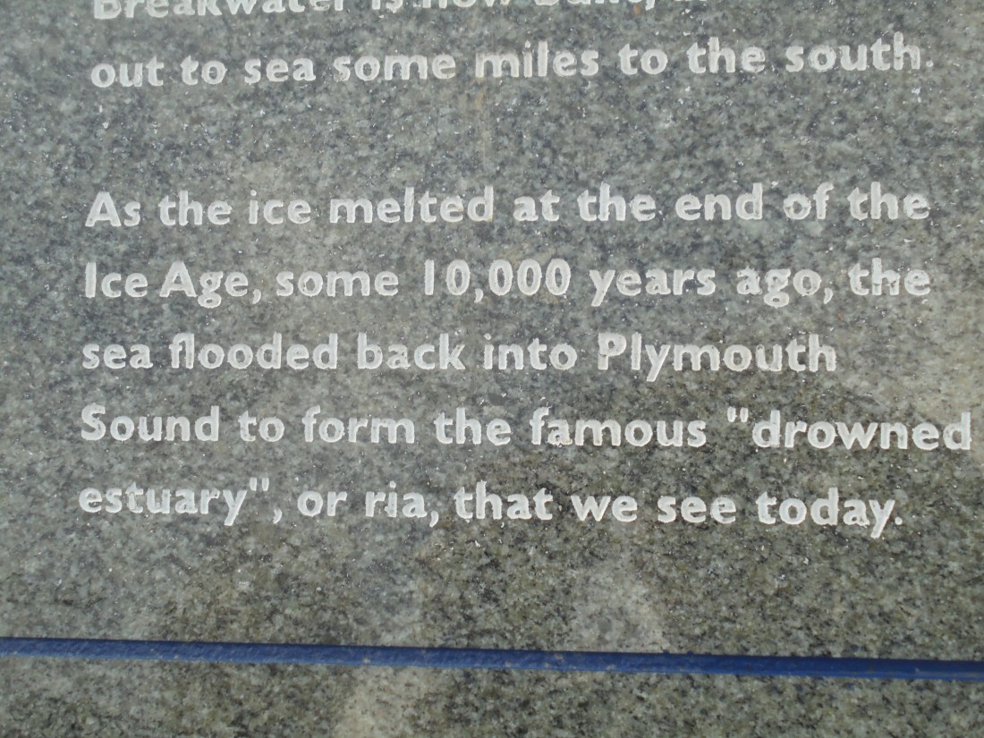
An excellent stone tablet spelt out the longer history of the Sound and the sea levels that accompanied geological and climatic change. 20,000 years ago the sea level was 130 metres lower than today. The text describes the current rise in sea level as 1-2mm a year, but does not predict the level in 100 years’ time. It also firmly describes the Sound as a ria which must put that argument to bed.
At one o’clock we were on the top of Mount Batten looking out over the breakwater. Walking round the Point to the ferry there were lots of reminders of the area’s past. The naval heritage is everywhere, but there is an RAF – and RAAF – connection too with information about the Sunderland flying boats stationed here during the Second World War.
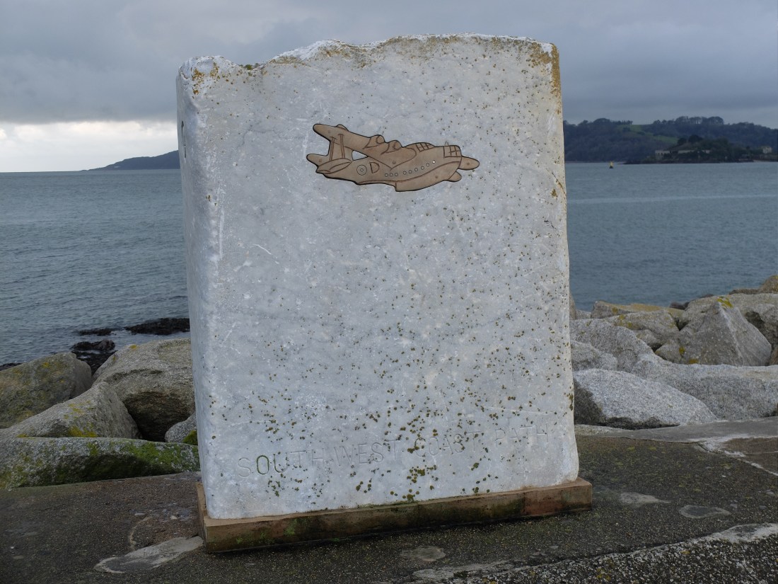
They were mostly units of the Australian Air Force engaged in anti-submarine patrols. There are some hair-raising YouTube clips of the aircraft taking off across the Sound. There does not seem to have been a designated water runway: the flying boats shared the water with all the other traffic!
The ferry shelter was cold and wet so we were pleased to see the ferry leave Mayflower Steps and head for us. It disgorged a surprisingly large number of people, but we were the only passengers on the way to the Barbican. Our ferry skipper was a man of few words but he got us there efficiently.
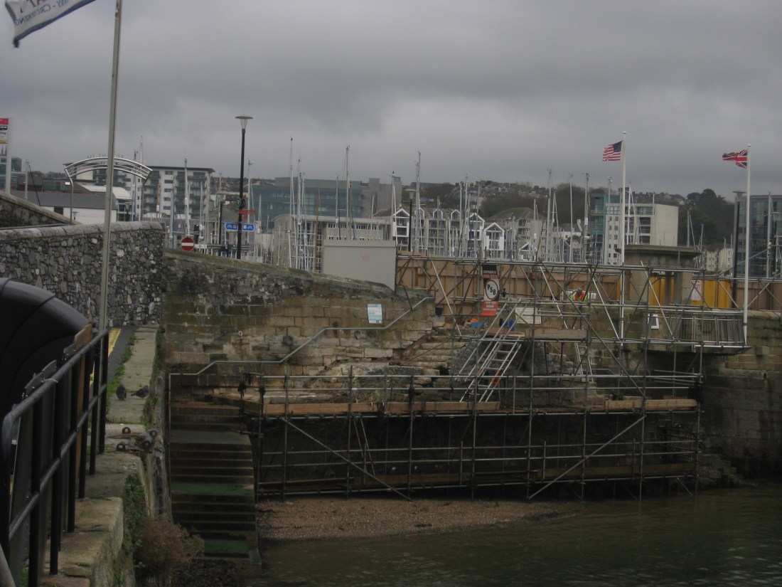
The original Mayflower Steps are being restored in time for the four hundredth anniversary of the Mayflower’s departure in 2020.
Walking along the seafront below the Citadel we got the full blast of the onshore wind and its rain, so we did not linger long. Enough though to get Martin and Smeaton’s Tower together.

We were intrigued by a history board describing Napoleon’s brief stay in the harbour in 1815. He was being held on board HMS Bellerophon before his departure to St Helena. In the six days he became a major tourist attraction. Jules Girardet’s painting is a much later imagining of the event, but there does seem to have been a frenzy of visitors. Girardet’s image suggests hero worship.

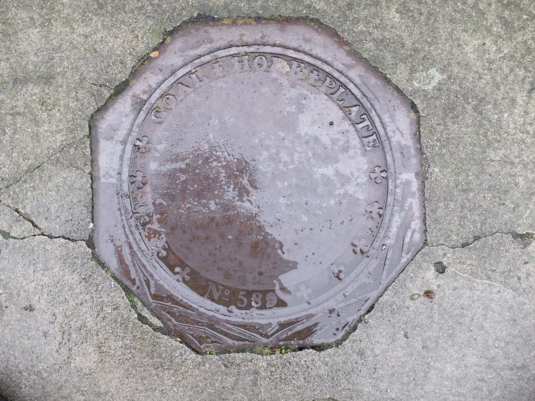
Our walk from the Hoe round Milbay Docks gave us a varied picture of the city. The areas bombed and rebuilt after the war are mainly uninspiring. Alongside them are some very attractive Georgian areas before Stonehouse Barracks. More heading South including houses with coal hatches still let into the pavement.
Rounding Devil’s Point we were nearly in touching distance of Cornwall.

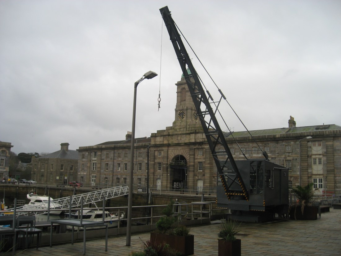
The finale was walking through Royal William Yard which is spectacular in every way: striking architecture, huge scale and wonderfully intact. We walked through it with pleasure and on to Cremyll Ferry – the end of Devon.


In 2018 we have completed the path through Dorset and South Devon and covered 214 miles, just over a third of the South West Coast Path. It has been a walk of discovery, great variety and wonderful views. We are looking forward to Cornwall in 2019.

Well done guys! Just catching up with your tales, better late than never! Hope you’re enjoying Cornwall and the Cornish; but not as much as Devon and us Devonians. Remember, it’s cream first then the jam!!!! Happy walking, Kathryn
LikeLike
Kathryn – good to hear from you we have not forgotten the great hospitality we had in West Alvington. We will recommend to others and the debate about rias continues. We hope you have a successful 2019. Dugald
LikeLike