
Time in Coronaland passes slowly. In those far-off days we had not considered the idea of ingesting disinfectant to combat a virus. Nor had we then understood the medical wisdom of the POTUS. Today the week we spent walking in Cornwall at the end of February seems a lifetime away. We walked freely on the coastal path for our first outing in 2020. We made good progress and expected to be celebrating our arrival in Minehead before the end of the year. Now that’s just a dream. But the memory of the north coast of Cornwall in the immediate aftermath of Storm Jorge is one to hold.
February delivered six inches of rain across England, which was apparently 258% of normal. It was wet underfoot and Jorge was still blowing himself out. Our first day was 29 February, the day after his peak.
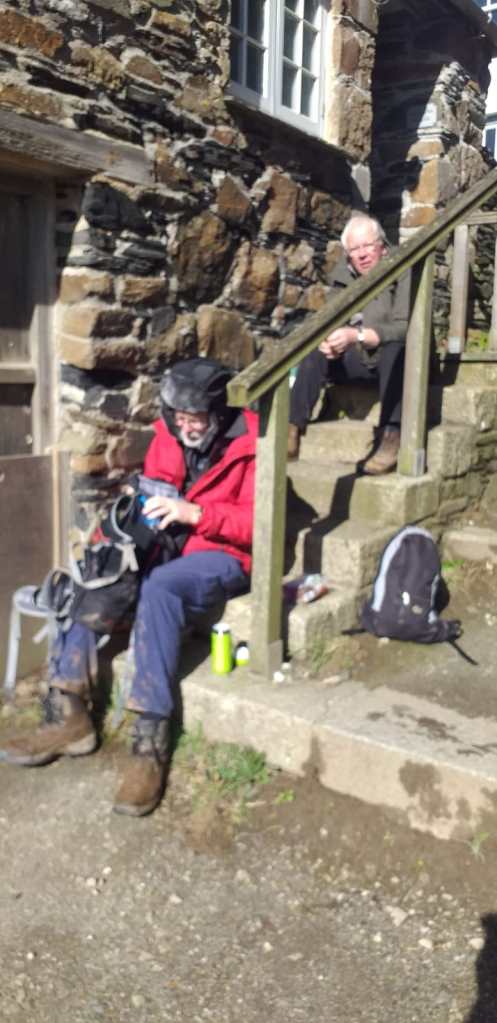
We were based in St Teath in a comfortable country cottage. We are getting experienced in Cornish holiday lets – this was our fifth. We had a full team, Anne and Richard, Martin and Sally, and Dugald and Wendy, boosted for the first couple of days by Wendy and Anne’s cousin Sarah. Sarah has robust opinions and gave a refreshing commentary on our team dynamics.

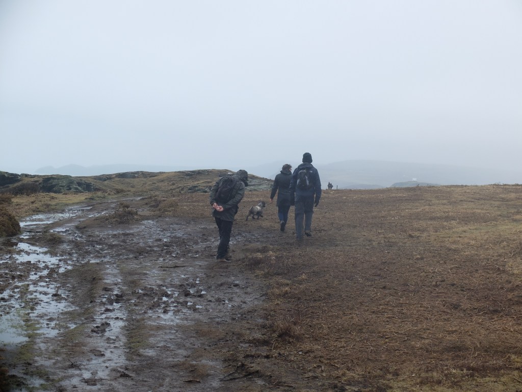
On 29 February we drove through the attractive Allen Valley to Mawgan Porth. When we got to the coast the wind was ferocious. There were a few hardy locals on the beach with their dogs, but sensible people were at home. But our target was Bude so we had to get going.
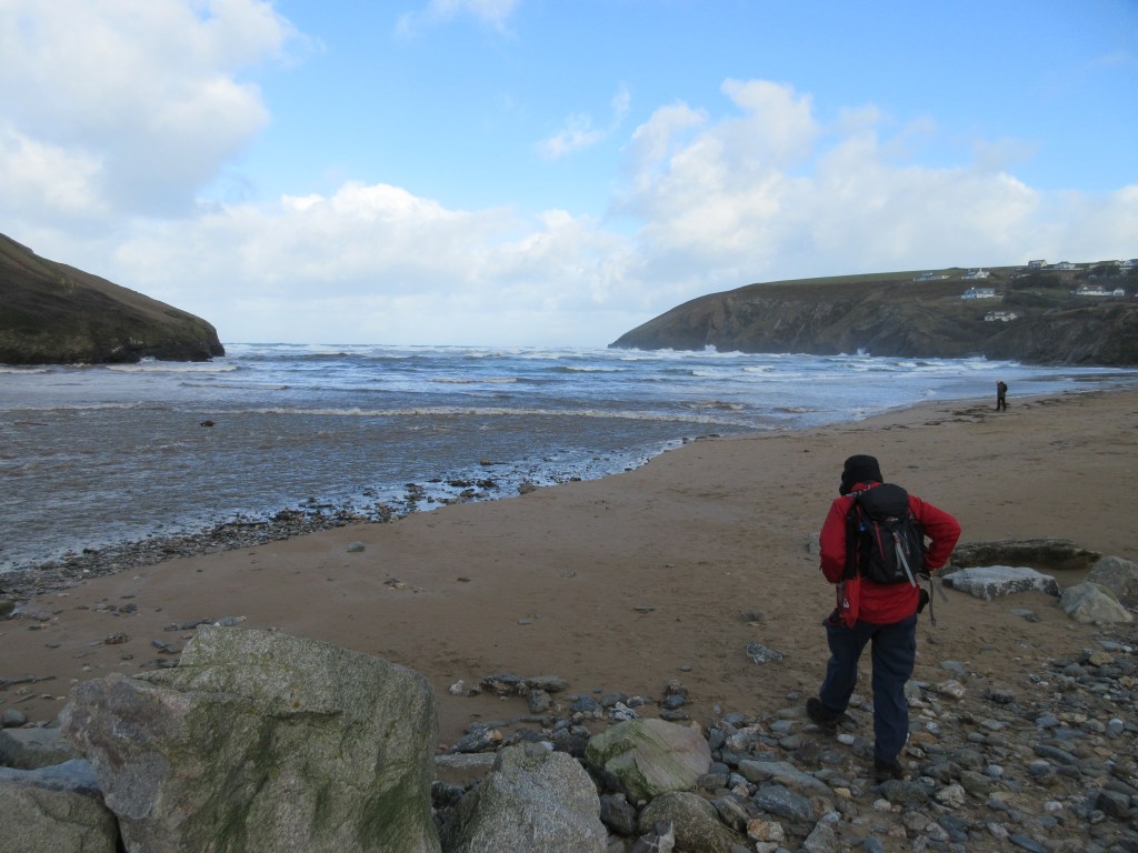
Once we were on the top of the cliff we felt the full force of the wind. Fortunately it was a north-westerly blowing inland. Although we had to grab a fence post every now and then, it was for stability not life-saving.

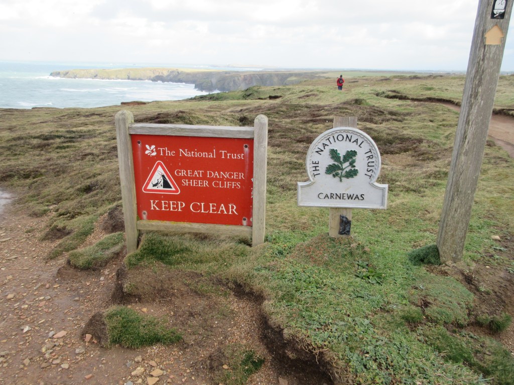
The walking was difficult. The warning notice seemed appropriate
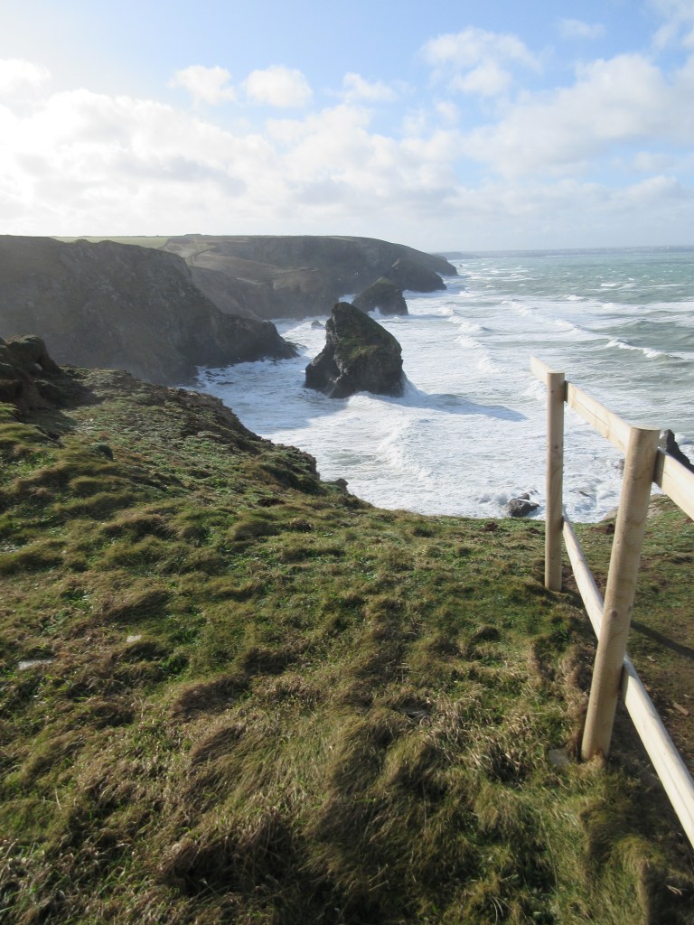
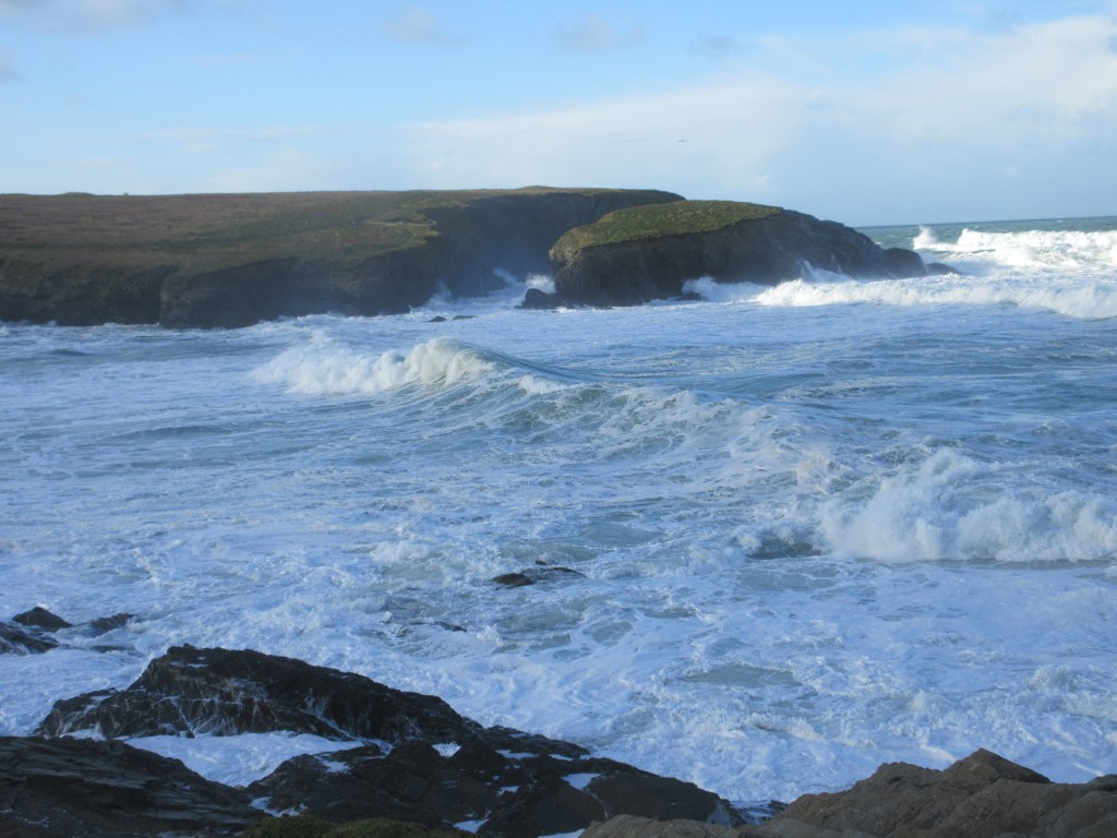
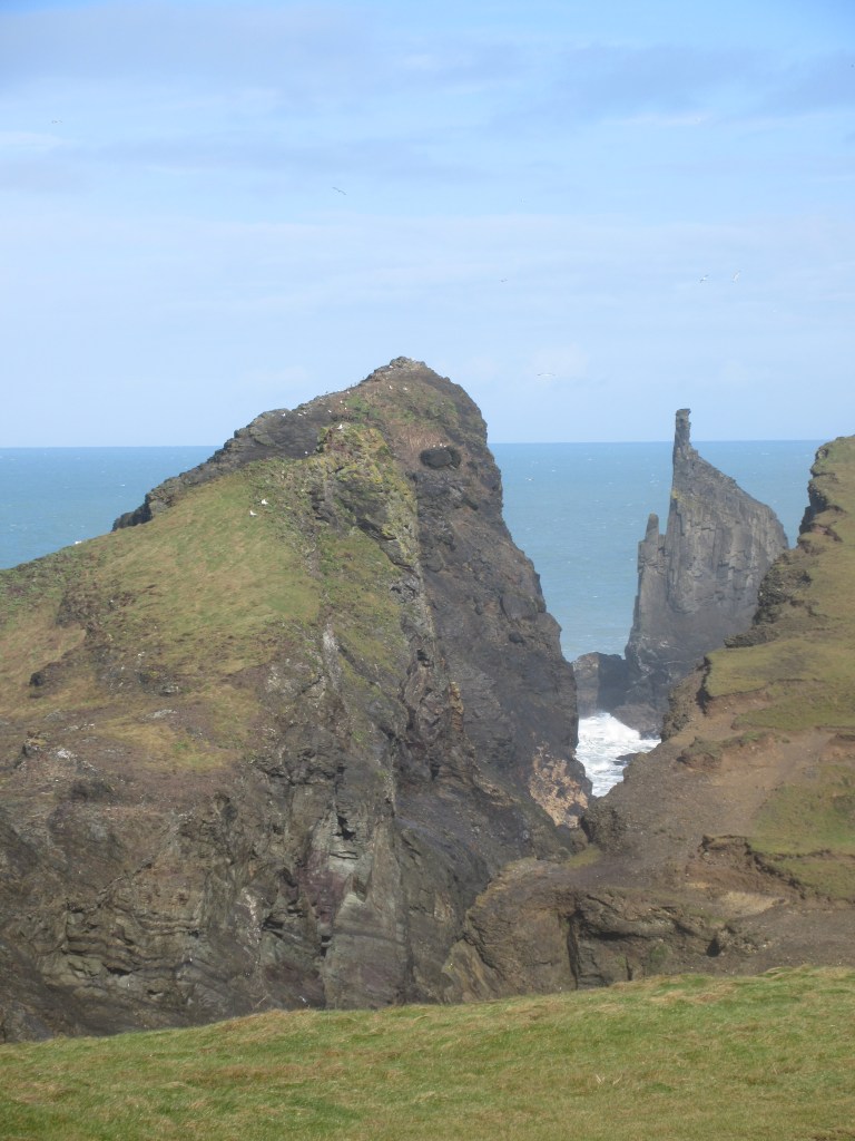
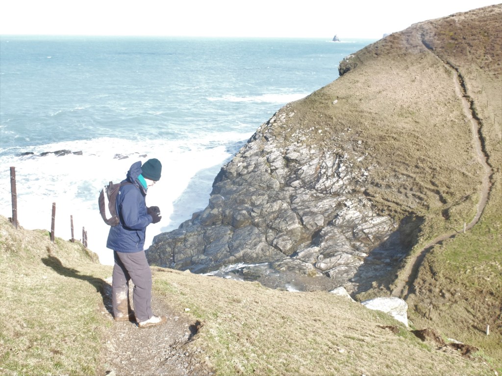
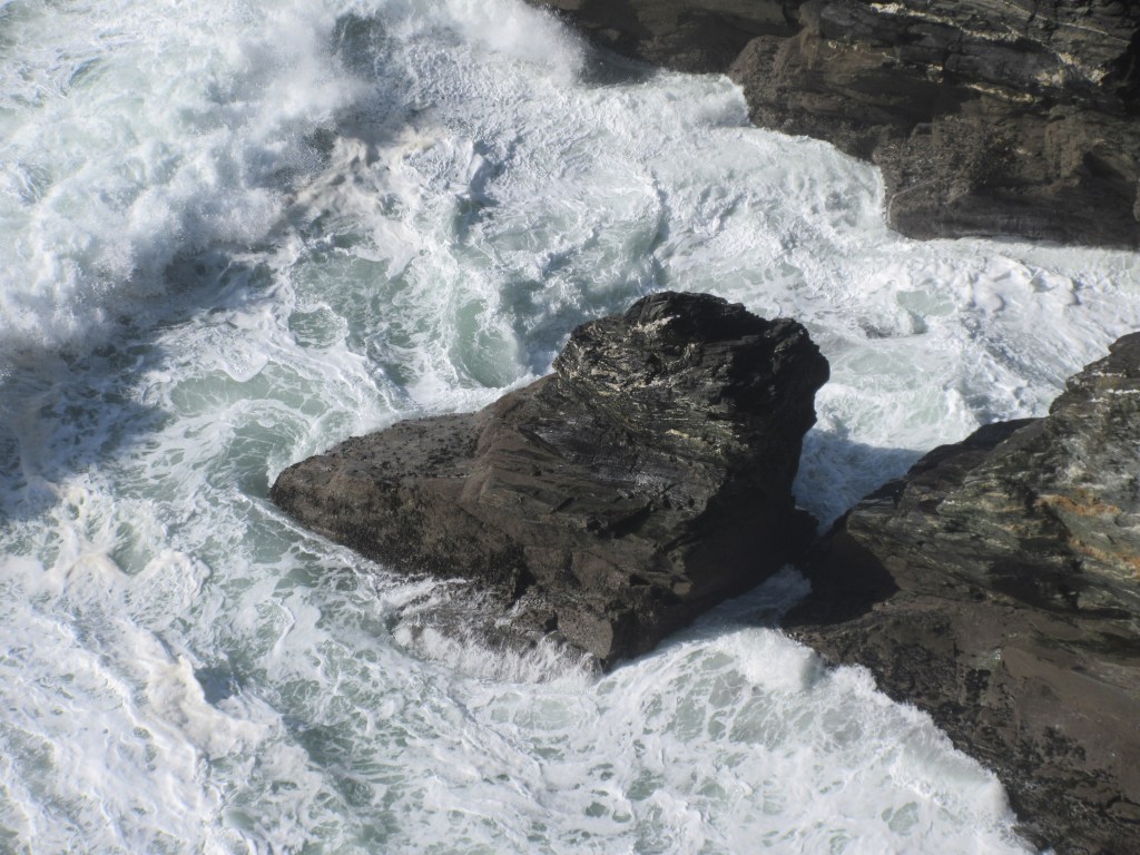
But the view of the sea boiling with foam was spectacular. The wind tossed it around in random ways.

After a couple of hours we were through Porthcothan. We stopped for coffee and water, but it was hard to get out of the wind. Martin lay down in the lee of a bush. Touchingly a young running couple stopped to check if the three old men were in trouble. We thanked them and assured them we were fine. At the time this was true.
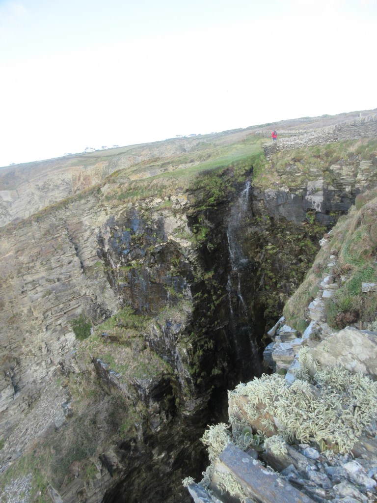
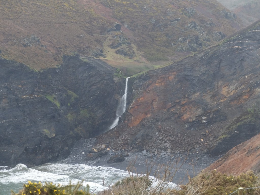
The next stage had more views of the sea for us including a waterfall being blown back over the cliff edge.


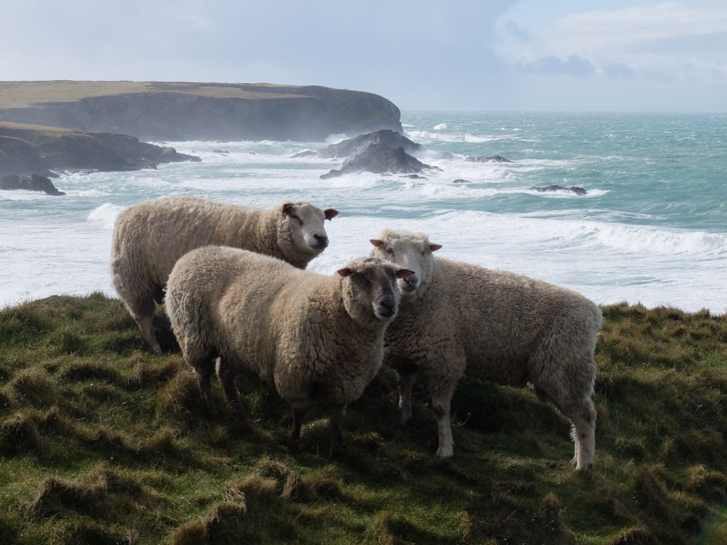
The sheep looked relaxed in the storm.
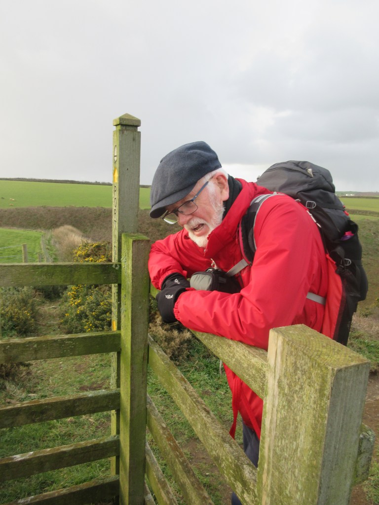
We were doing well when we got to Treyarnon Bay just after midday. The tide was out. Like many of the North Cornwall bays a small river snaked across the sand. We wanted to cross it to avoid a diversion round the head of the bay. It looked promising. The choice in crossings was wide and shallow or narrow and deep. Martin splashed through a wide part. Dugald went to survey the narrow and deep and decided it was high risk. Richard, perhaps emboldened by Dugald refusing the fence, decided he would jump.
He went back for a long run. He set off with all the horsepower gained from park runs at Montacute. The tide had levelled off the sand carefully to create a smooth surface. It must have missed a bit because Richard’s toe struck a tiny ridge and he dived head first into the river. There was no time to rescue him because he was out of the water in a flash. A jack rabbit would have envied his speed. But he was wet and it was cold. Time for a quick rescue.

Wendy and Sarah had selected Rick Stein’s Cornish Arms at St Merryn for lunch and were about to order when the rescue call came. They abandoned the pub and picked the bedraggled team up. After delivering them back to the cottage, they returned to the pub and resumed their lunch.
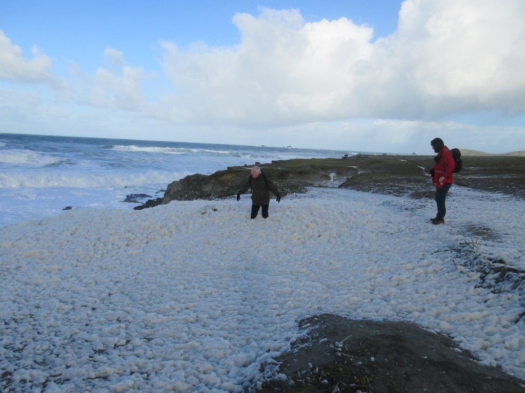
Back at Treyarnon the next day Richard was in dry clothes. The wind was still strong but had abated a bit. One surprising effect of the wind was the sheets of foam on the shore.
A group of oystercatchers was holding a meeting.
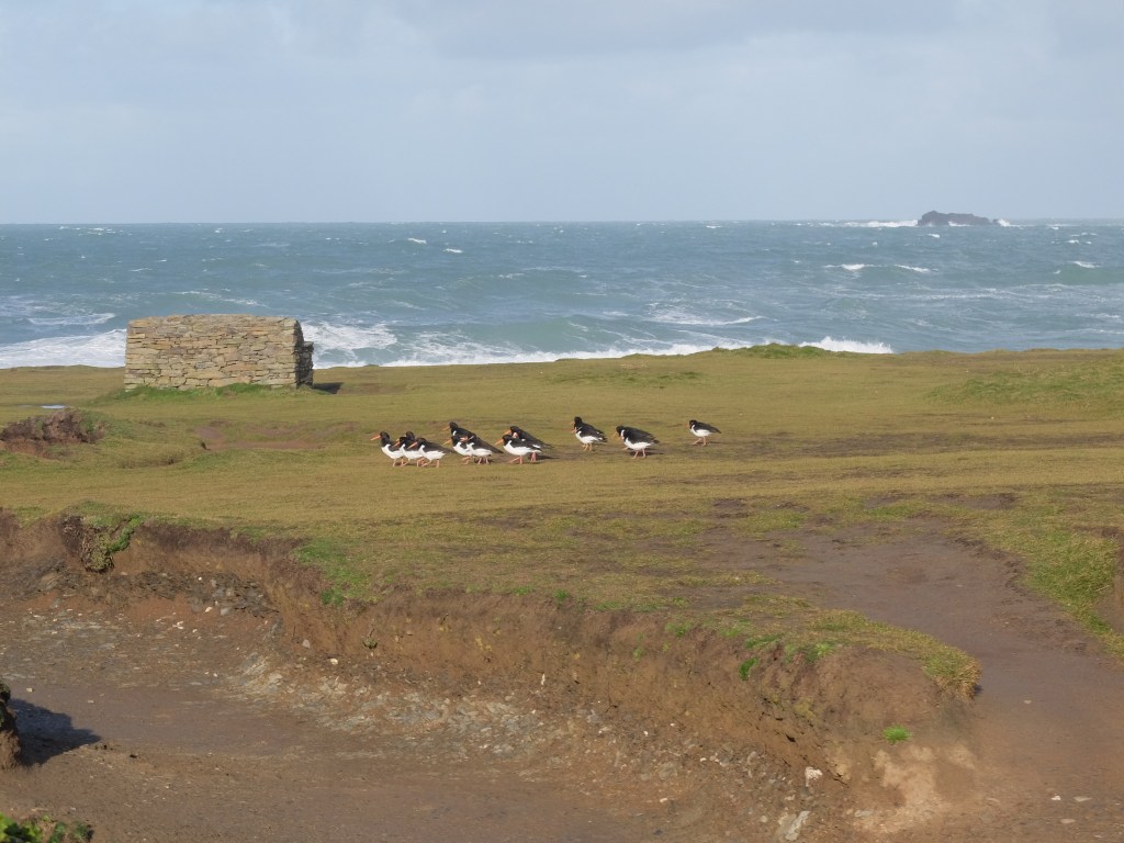
They finished their meeting and we had to move on too.

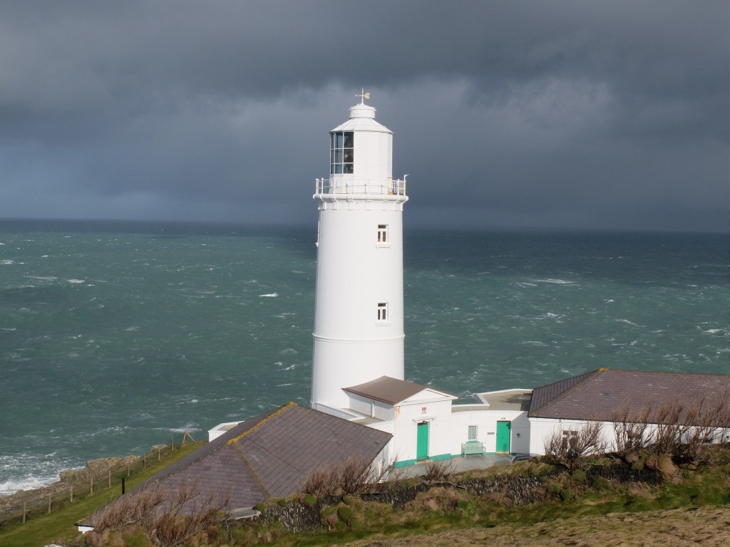
The first stop was Trevose Light. The sea boiled as we headed for it.
Getting to the light the view opened up to the east split dramatically between light and dark.

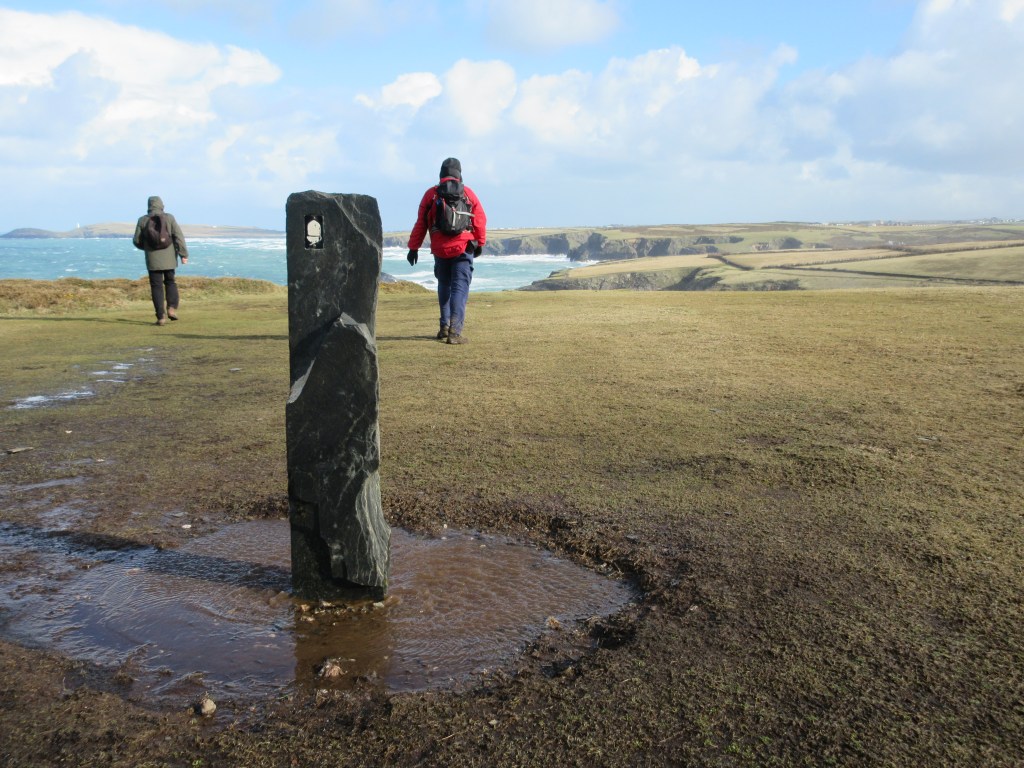
As soon as we turned east and got into the lea the wind dropped away. It is extraordinary how a slight change in position makes a huge difference. A bit further on a bench beckoned. Then it was acceptable to break one’s daily exercise with a bench stop.

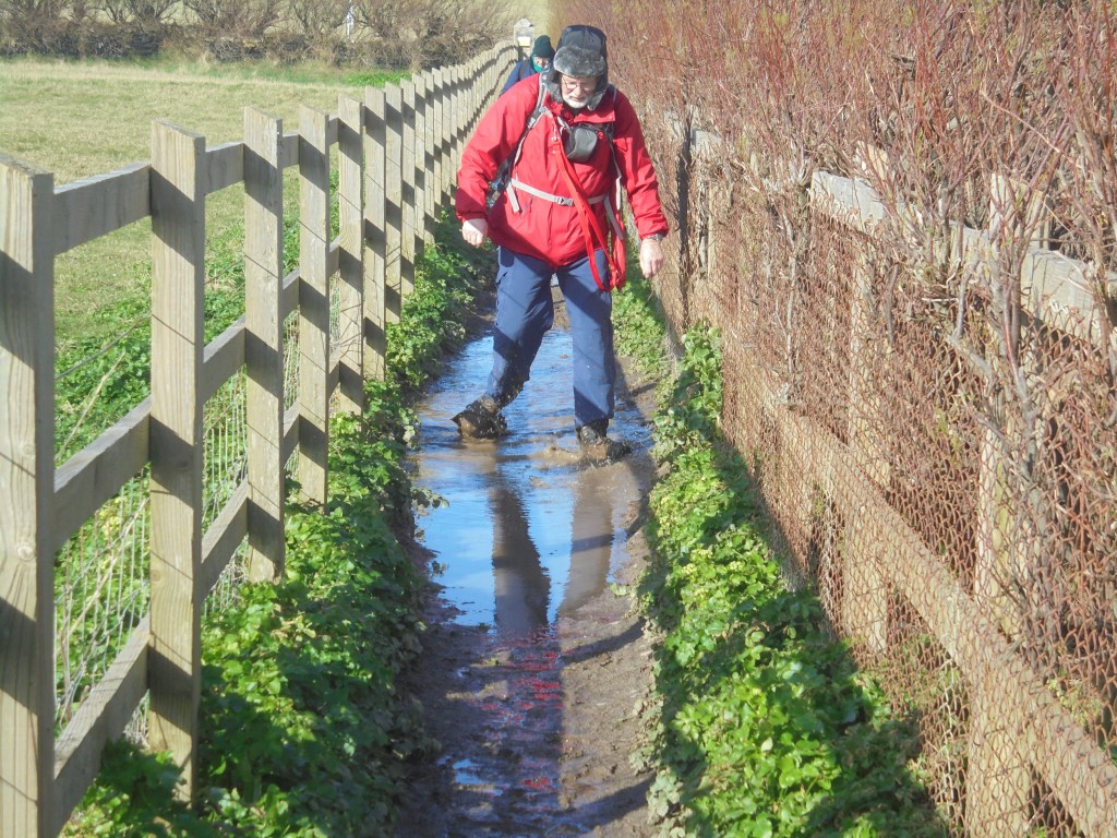
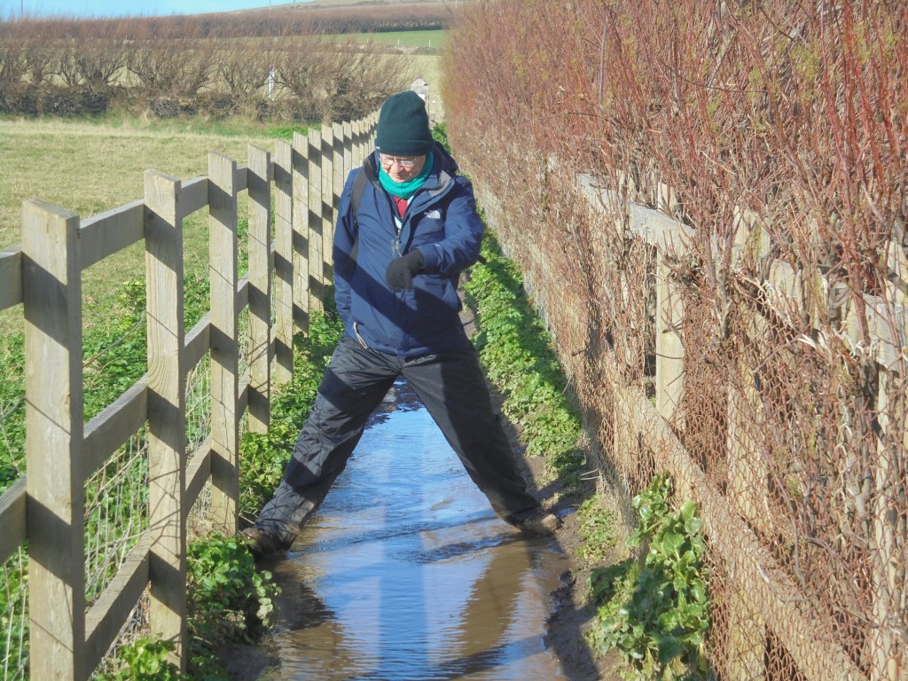
At points the path was narrow and the effect of the last month’s rain became clear.
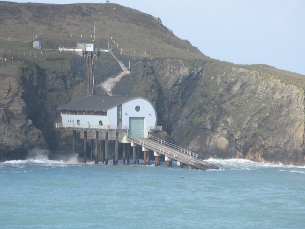
We passed the new lifeboat station for Padstow which was built here as a result of the Camel Estuary silting up. It’s a dramatic setting for a launch.
By 11.00 we had reached Harlyn Bay. This was our planned destination for the previous day before Richard’s melodramatic immersion. Here there was fortunately a bridge across the river so he wasn’t tempted to make further leaps.

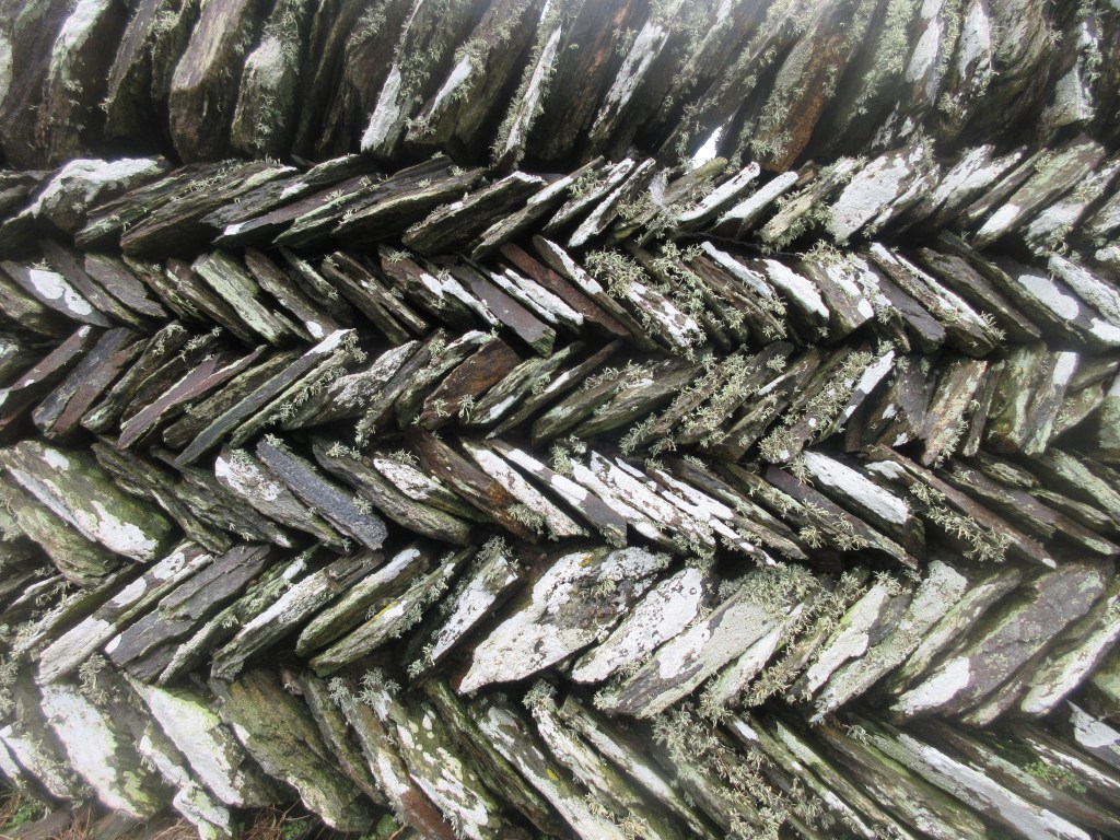
The rocky bay at Trevone coincided with the first rain. Martin said he saw two choughs getting ready to shelter. A bit later we were attacked by a vicious hail storm. Luckily the wall of a disused quarry gave us shelter. But we also noticed interesting and diverse varieties of moss on the wall.


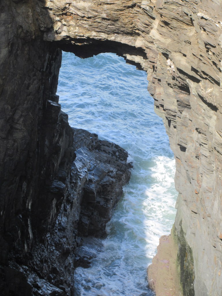
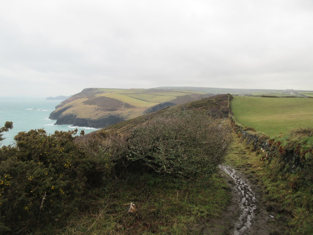
Heading for Stepper Point we went through Tregudda Gorge which was less threatening than its name.

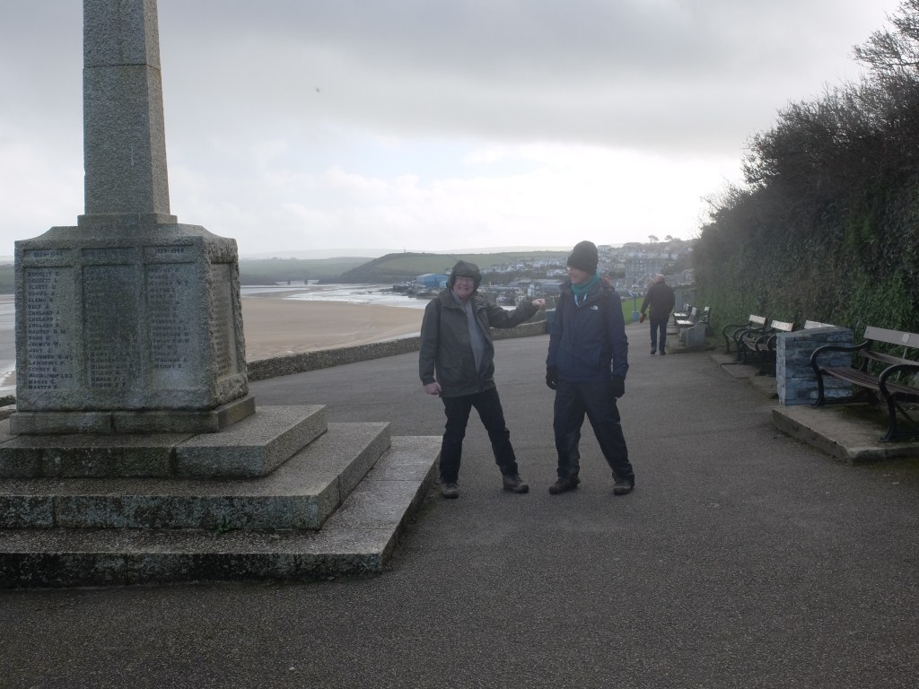
Rounding the point we were now on the western side of the Camel Estuary. It should have been plain sailing. But it was wet and miserable. Getting round the small river at Harbour Cove was like the Slough of Despond. There followed endless fields of cauliflowers until eventually we found the war memorial at the top of Padstow.
From there it was downhill until the bar of the Custom House where much needed refreshment was taken.

We did not take the ferry. Wendy did that for us the next day.
At Rock car park the next day it was bright and breezy. The prospect offered by the guide was easy then strenuous. But at least Jorge seemed to have moved on. A sandy beach start took us past a boat slowly moving up the estuary.


Behind the dune to the east we passed St Enodoc Church, hidden but with a good story. Built mainly in the fifteenth century, from the sixteenth to early nineteenth century it was engulfed by sand. To overcome this the vicar and the congregation had to enter the church through a hole in the roof. In 1864 it was dug out and restored to normality. John Betjeman was buried there in 1984.
Above Greenaway Beach we looked down on sixteen oyster catchers and two curlews.
In Polzeath the lovely day suddenly turned into a hailstorm. Onwards up a long slow climb to Pentire Point.

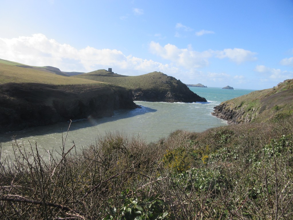
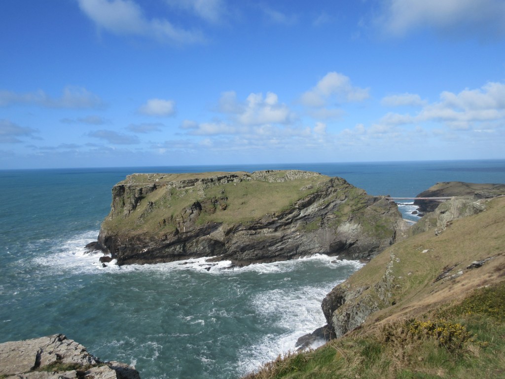
To the east the Rumps stuck out from the headland, an Iron Age fort with boundaries that are still clear. Indeed the boundary wall is visible from many miles away. It feels a hostile place, but its value as an easily defended point is obvious.

Going past Lundy Hole we were getting to the more strenuous bit.

By lunchtime we were in Port Quin, a tiny village at the head of a very perilous entrance. It is marked by two houses with interesting stories. On the left of the path was Doyden Castle a small square house built by a Wadebridge man who enjoyed having an isolated spot for drinking, gambling and other entertainments. A larger house on the inland side of the path was built at the beginning of the last century and was the retirement home of Captain Conor, the former governor of a London prison.


The village has a sad past earning the description “The village that died twice”. The first death was the result of the total failure of pilchards in one year; the second when all the men of the village’s fishing fleet were drowned on one night in 1697. Today it is a small and charming place, but it must have been dramatic when Jorge was doing his worst.
We sat on the steps of some holiday cottages for our lunch. We discussed and rehearsed the lyrics of the Mighty Quinn. “You’ll not see nothing like the Mighty Quinn”.
The last three miles to Port Isaac were rated strenuous and they were. A series of steep rises and falls, punctuated by flights of uneven steps tested our lungs and stamina. The signpost half a mile from Port Isaac was a welcome sight.


Port Isaac is narrow and attractive, but no place for a car. So we had to climb out of the village to meet Wendy in the car park up another steep hill.
A number of things coincided the following day: the walk from Port Isaac to Tintagel was rated severe; Martin had to visit a gallery to view his prospective birthday present; and the starting team was down to two. Early in the morning we were on our way to Tintagel.
At the top of the hill we passed a smart holiday house called Silver Spray where Anne and Richard had stayed in the past. At the bottom of the garden was a wall. Not long before Anne and Richard’s stay a playful game of football in the garden ended in a guest going over the wall to get the ball – and falling to his death.

This was a day of many rises and falls on the path, assisted by over 800 steps.


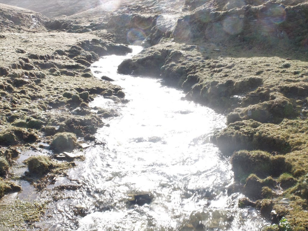
At the bottom of the dips springs were running strongly.

It was hard work and there was heavy breathing at the top of many of the climbs.
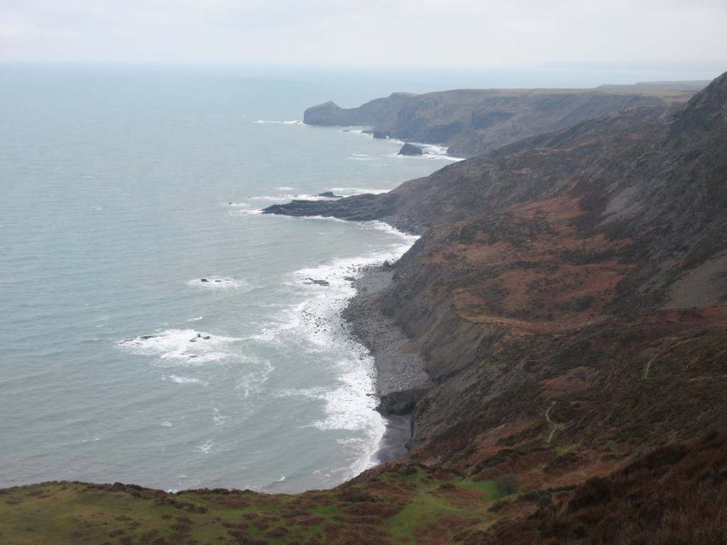
Bounds Cliff is said to be the highest cliff in Cornwall. We passed it and paused for a short break at Tregard Cliff. Further on just before Gull Rock a lion shaped rock lay in the surf.

Alongside the endless rises and falls the coast provided striking rocks and scenes.


We arrived just above Tintagel Island in the early afternoon.
There are only five sections of the path rated as severe. The walk from Port Isaac to Tintagel is one of them and it certainly deserves the description.
Back at the cottage we could see Martin’s haul for the day. The present was a picture of choughs returning to Beacon Cove. This is just north of Stem Cove, the last redoubt of the original chough population, pointed out to us by Martin in November.

But he had also been pursuing his secret ambition to be a huer. Back in Newquay Martin had scaled the huers’ watchpoint and imagined himself pointing to a shoal of pilchards to alert his fishing friends. Employment prospects for huers are not good today, but if you should spot a vacancy please let Martin know.
Milo felt he had not had a fair share of the walking so on the fifth day he brought Martin and Sally. We set off for Boscastle on a cold and breezy day.

We passed a group of black Hebridean sheep which looked quite comfortable in their long coats. Just after Willapark we wondered what Sue had done to deserve her inscription.

Rain had not been forecast but arrived anyway. Any concern about the weather was allayed by a man walking purposefully in the opposite direction who said it was “just the weather for it”. How could we disagree?
The rain oddly came from the south-east. It proved to be just the weather for falling over too. First Martin took a tumble. Then Dugald slipped and fell flat on his back. Time to stop for a break just beyond Fire Beacon Hill. Three women who looked to be in their eighties passed full of cheer and looking very fit. Fired up by their example we carried on.

At midday we crossed a “challenging” wall. For once the description seemed an exaggeration.


On a cliff to the west of Boscastle a large group of fulmars was jostling for territory with aggressive challenges to anyone with an attractive spot. It looked hard work.
Just round the corner was Boscastle, hidden from sight until the last minute. A tortuous entrance to the harbour leads round to the village. The river was flowing quickly. It was easy to see how it could explode as it did in the flood of 2004.


We settled in the Long Bar for an excellent bar lunch with Wendy and Anne. Milo warmed himself by the fire. Martin sat near him. Six of us sat in close proximity to eat, drink, talk and laugh. A normal event then.
Our last walk was from Boscastle to Crackington Haven. Martin and Sally opted for exploring the Camel Trail. Walking along the eastern side of the harbour emphasised its narrow entrance.

A short sharp climb took us to the cliff and acres of glutinous mud.
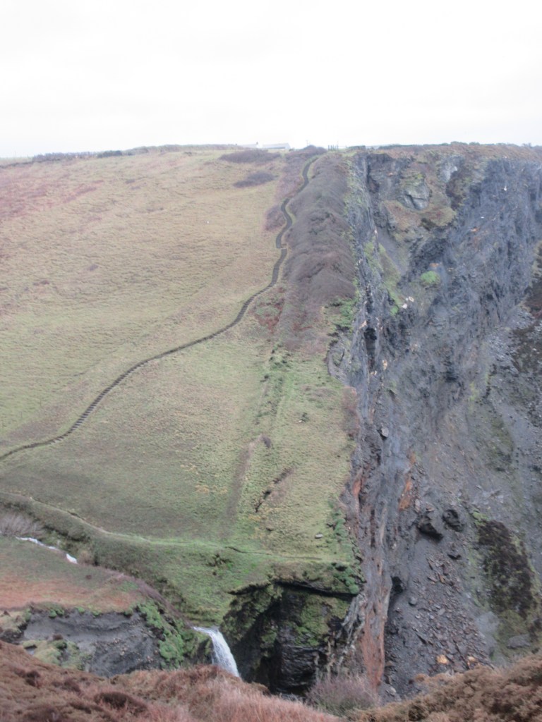
Reaching the top we could see an attractive waterfall at Pentargan.
The path took us over the stream above the waterfall and up the cliff again.
The next stage was a rough and stony path, a bit like the undercliff.
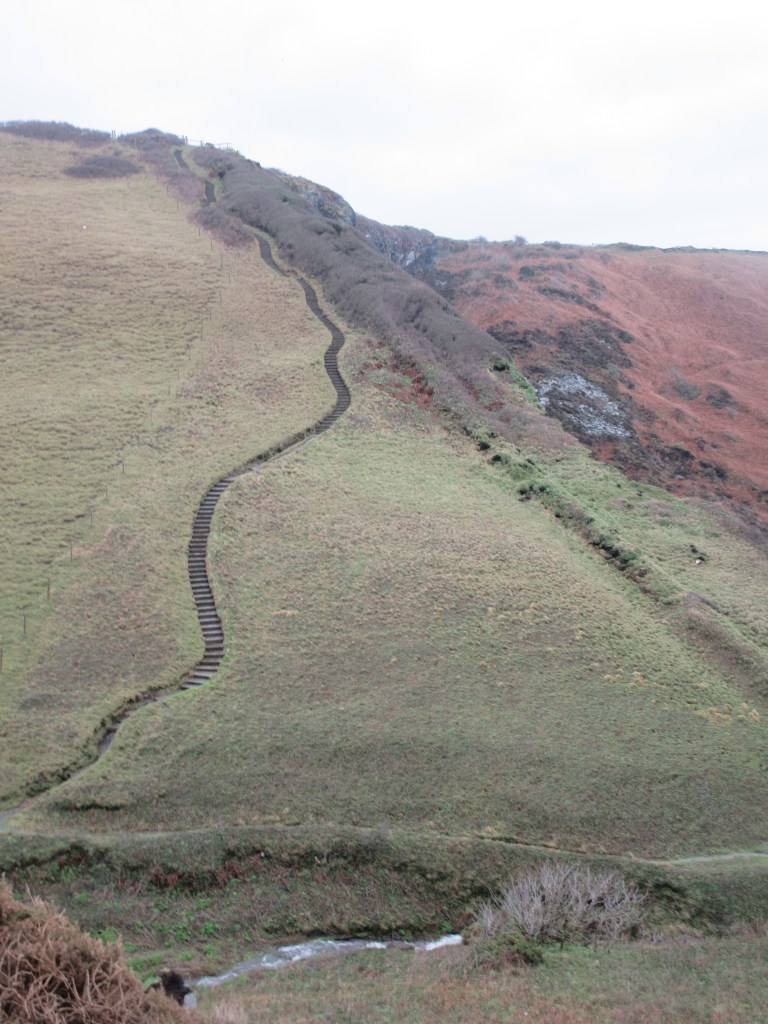
Then a long and difficult climb with steps and zigzags to the top of High Cliff. The view from the High Cliff stretches from north through east to south, but not at its best on this grey day.

But whatever the weather the views of the coast and its rocks are intriguing.


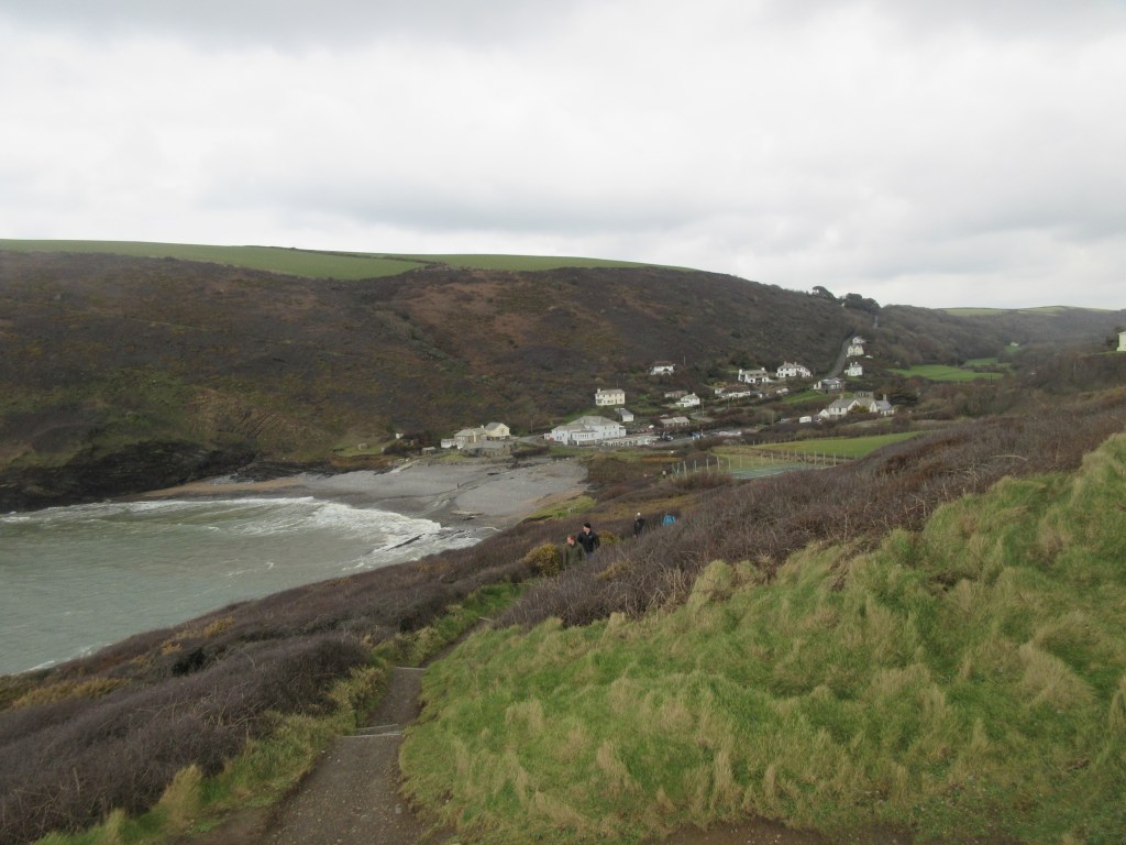
Crackington Haven is apparently very fashionable, but it’s not striking as you approach it. It was nevertheless a welcome sight. So was the Coombe Barton which we reached two minutes before food service ended. Good timing at the end of a day described by Richard as a “day to endure, rather than to enjoy”.
At the end of our week we had only covered fifty miles and had not reached Bude. However, finishing the 135 miles to Minehead before Christmas looked easily achievable. That was the view on March 5th. Just over two weeks later with lockdown biting it looked very unlikely.
We had a week of cold and wet weather, but viewed from Coronaland we were free to wander and to enjoy Cornwall.
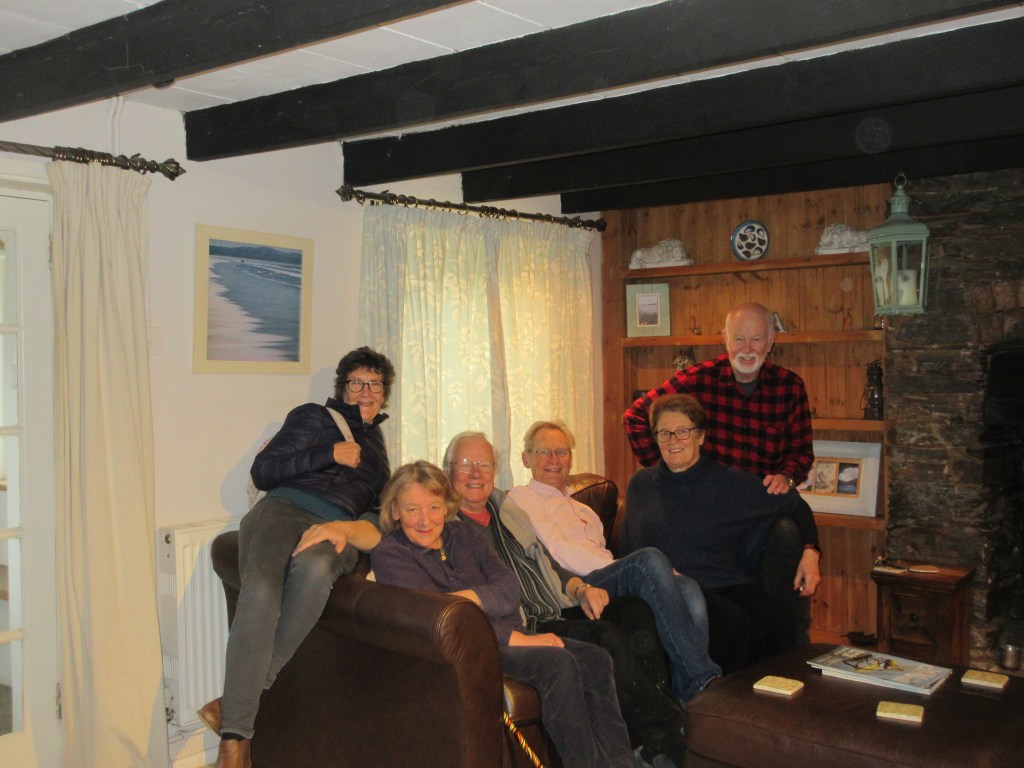
As for sitting together on a sofa……….

