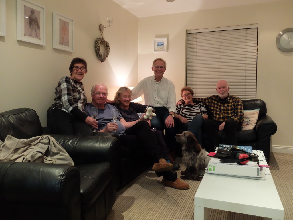
We drove down to Cornwall in atrocious conditions. It was the last day of British Summer Time and the beginning of our last walking week in 2019. The house Wendy had found in Crantock near Newquay could accommodate six plus Milo, but parking in this tiny holiday village was difficult. The clocks moved back and the rain stopped.
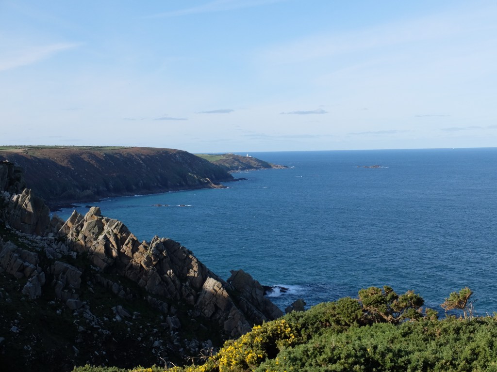
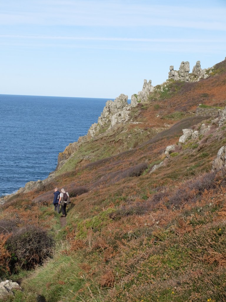
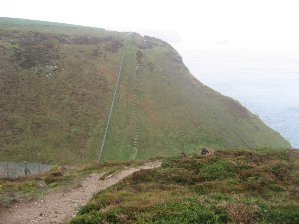
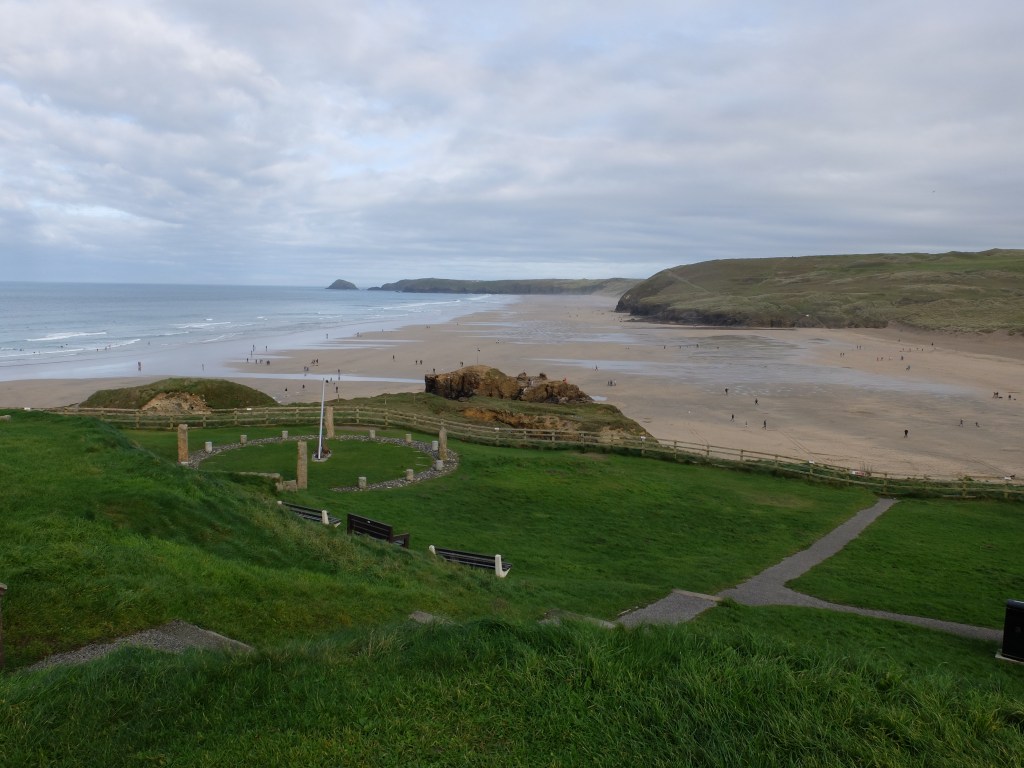
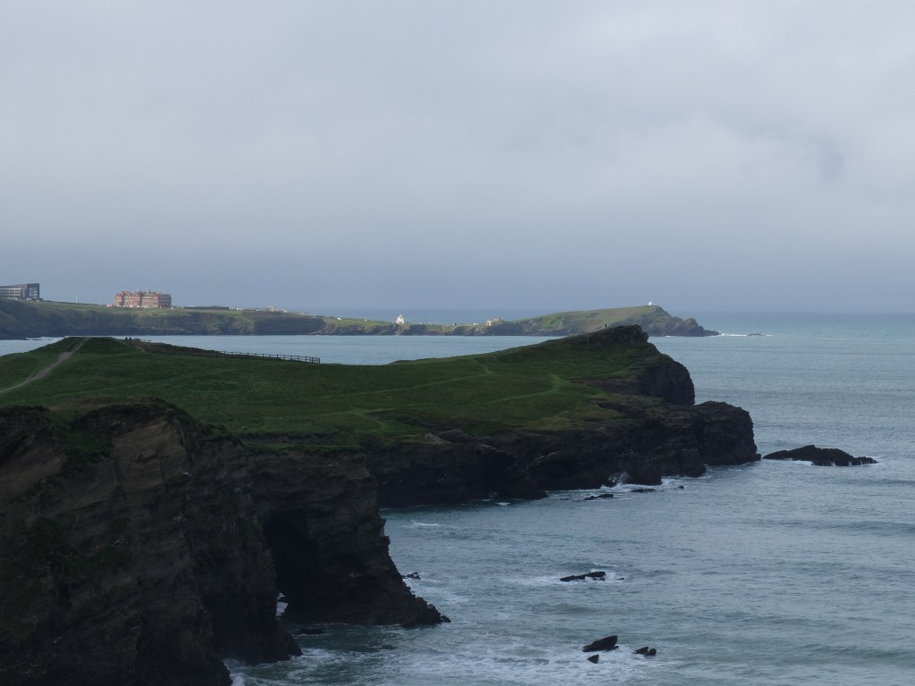
Sunday was bright and the car park at Long Carn welcomed us back. Martin had a new pair of boots and was jiggling around like a highly-strung horse in the paddock. We were about to discover whether the guide’s description of the section to St Ives as ‘severe’ was justified. It did not take long. The landscape of scattered granite boulders was not designed for walkers and the path was tortuous and rough.
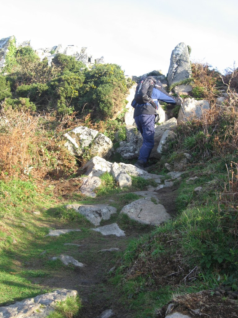
The ground was very boggy after recent rain. Much of the path was a running stream but at least the rock surfaces were dry.

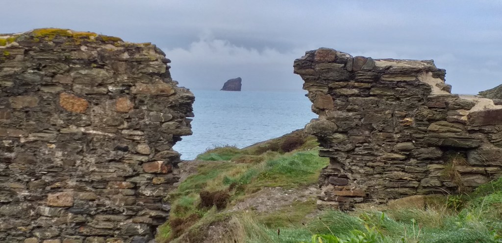
Bosigran Castle was an Iron Age settlement.

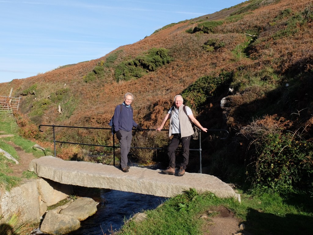
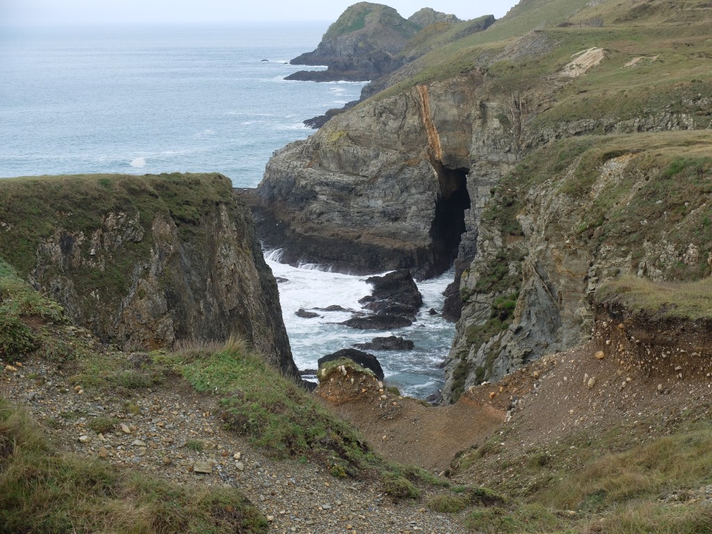
Shortly after it came our first sighting of choughs, a pair gambolling in the wind high above us. This excited Martin but more was to come. About an hour into the walk we had a short period of smooth grassland at Porthmeor Cove. This was a temporary relief because the rocks required constant concentration to avoid a broken ankle or worse. A civilised bridge took us across the top of the cove.
There was a quick stop to check out a print on the path. The conclusion was a badger.

On past Gurnard’s Head we were making progress.

Just beyond the wild coast gave way to an attractive house with a wonderful and privileged position. One beach for the morning and one for the afternoon?

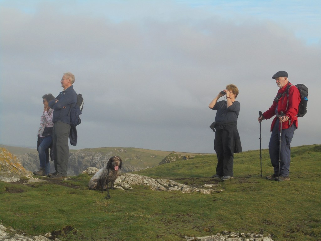
Carnelloe is a striking headland. But it was eclipsed for Martin by a flypast of five choughs.
When we got towards Zennor Head Martin met some fellow chough enthusiasts. A long discussion followed and might still be going on if he hadn’t been pulled away.

He might also have missed the real drama which was a flight of 23 choughs circling deliberately and slowly above us. It was a dramatic sight even for the cynics who suggested it was laid on by the local tourist board. After all the talk about choughs here was a wonderful demonstration of the revival of the breed in Cornwall.
After lunch we got to a section where the path disappeared among the rocks. We guessed our way through it. It felt like the rock tracking scene in Butch Cassidy.
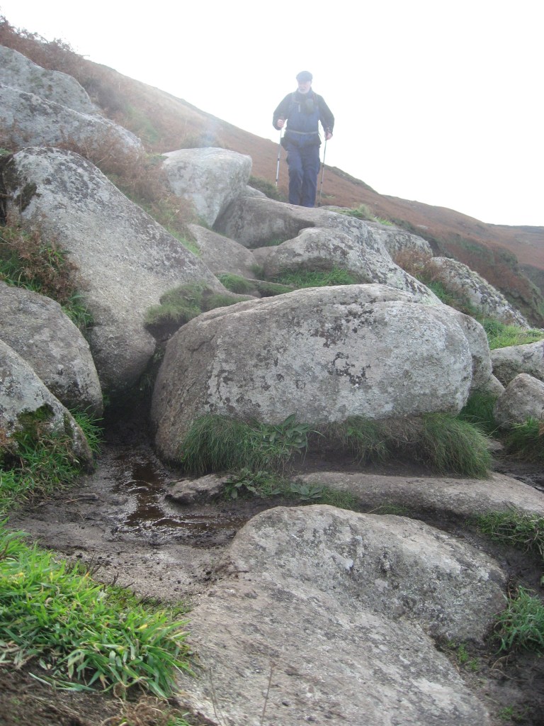
This looks like a mild section of it. Once out of this ankle trap we made quicker progress and in mid-afternoon the view suddenly opened up the bay ahead of us with its long beaches.

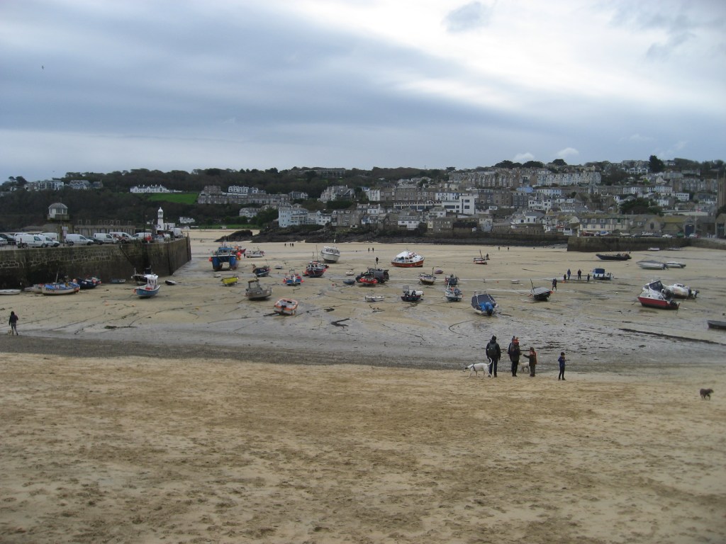
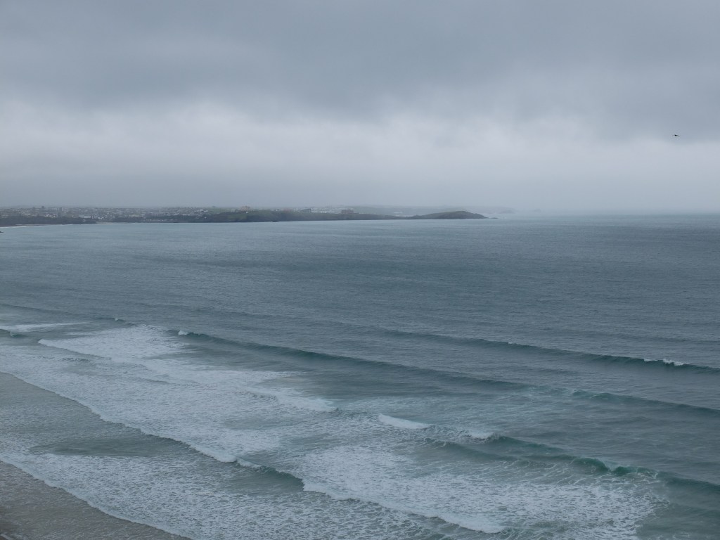
We saw our first seals inside the Carracks, an affectionate couple rubbing noses in the water. In the late afternoon we got to St Ives to meet Wendy and Sally. We agreed that it had been the toughest day of the 43 so far. Our average speed of 1.2mph lined up with the suggestion in the guide and was slow even for us! One of the surprises was that we saw lots of people along the walk, even in the remoter sections; and that there were lots of quite young children even in the hard parts. No snowflakes here.
The next day was a complete contrast. The walk from St Ives round the estuary at Hayle was mainly flat, mainly road bound and a bit monotonous. But it was a relief for our limbs. Back in the car park we watched apprentice surfers sitting obediently on their boards on the beach. In one corner an advertising board for the local café confirmed our view of the previous day.
We were soon walking past the Tate, but with no time to visit. Going through St Ives we were followed by a strong and enticing smell of cooked breakfasts. We resisted the temptation, but it prompted Dugald to suggest that a hot pasty for lunch would be a treat. The path went round The Island and we saw our first seal there.
Back by the harbour the tide was out and boats were being serviced on the sand by vans. It was remarkably quiet for the second week of half term.
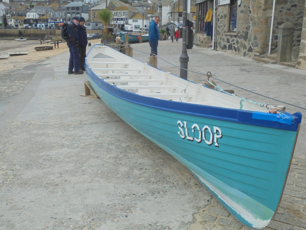
On the quay two of the local gigs were chained to the railings. There was a short stop to admire them.
At Porthminster Beach the full sweep of the crescent of beaches lay before us, roughly five miles of sand up to Godrevy Point, but interrupted by the estuary at Hayle. Climbing steeply up above the railway we were suddenly in affluenza. Spacious houses with large gardens lined the road in a verdant section before Carbis Bay.
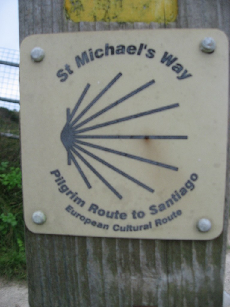
From the low cliff we came onto the dunes above Porth Kidney Sands. Here we realised that we were on St Michael’s Way as well as the coastal path. This was a route for pilgrims from Wales and Ireland to reach St Michael’s Mount without sailing round the treacherous coast of Land’s End. It was part of the network leading to Santiago de Compostelo.
We sat on the dunes for coffee and watched the river flowing through the sandy estuary. These sandy flows look insignificant until you get closer to them when their force and depth becomes clear.


We then had to head inland for the long road skirting the estuary. On the way we passed the church of St Uny. It was not clear what Richard and Martin were thinking as they surveyed the graveyard.

A quarter of an hour later we had a quick stop to admire a tree swarming with goldcrests feeding on insects. Onwards then to the causeway at the top of the estuary. Large numbers of teal and widgeon were feeding on the mudflats. On the east side we saw cormorants and a single curlew.
The entry to the town itself is in the former industrial areas. John Harvey was a pioneering engineer whose works supplied machinery for the Cornish mining industry and further afield. His main brick factory building still stands and is now occupied by Jewsons. There is no indication at all on the building of its origin or purpose. Zero marks for imagination to Jewsons.
Further on there were descriptions of Hayle’s glory days.
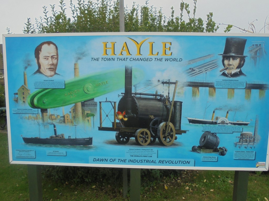
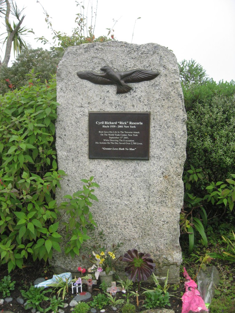
A more recent memory was of Cyril “Rick” Restorla who was the head of security at Morgan Stanley in the World Trade Centre on 9/11. A child of Hayle his direction of the evacuation saved almost all the bank’s employees. He lost his life in the disaster. Ironically he had warned the bank of the risks of the building. All this followed an extraordinary career in both the British and US armies.
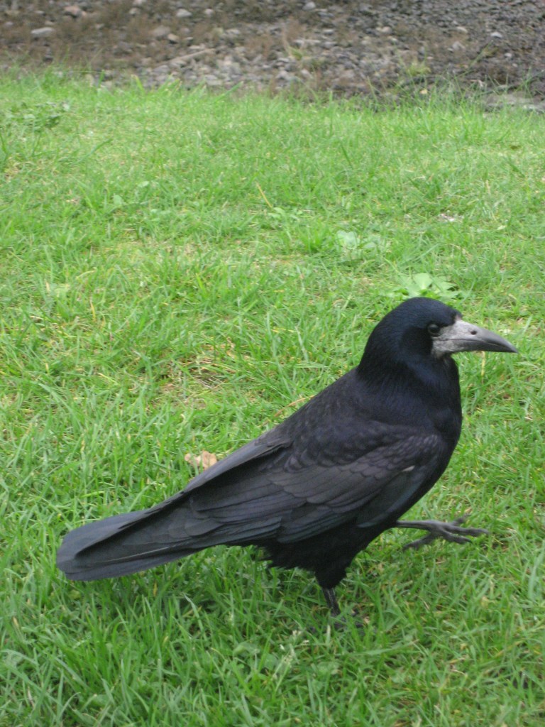
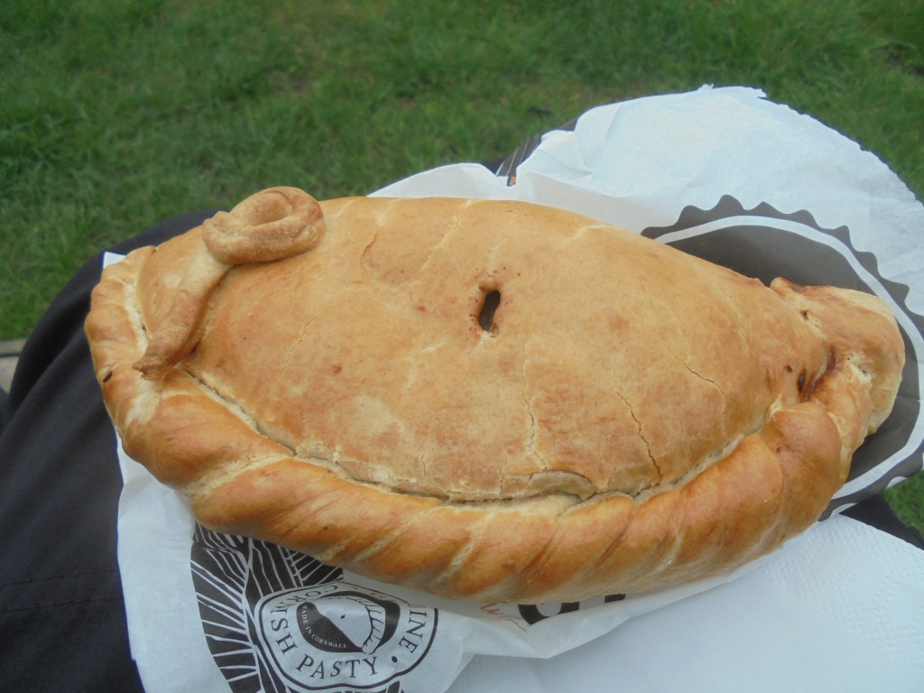
Just before one o’clock we were heading towards the north end of the town when we ran into the Philps pasty bakery – “providing famous pasties from Cornwall”. This was a lucky coincidence not the conspiracy Martin suspected. We bought and ate three excellent pasties sitting on a nearby bench. The local rooks had got the system sorted. A dominant male kept the patch to himself and stayed at just the right distance.
Refuelled by the pasties we left the town and were soon at the start of the dune system that runs north – the towans. These are well established dunes which create an extraordinary landscape.


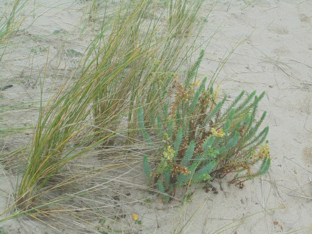
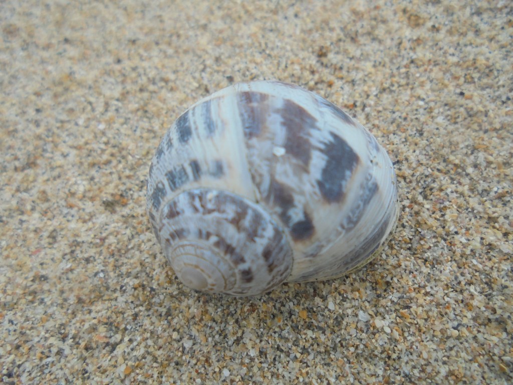
Martin was intrigued by the large number of snails in the dunes which are clearly a great food source for the birds.
At the north end of the dunes we passed through Gwithian Towans and arrived at the car park. During the day we had passed the 400 mile mark so a celebration was needed – and happened.
The forecast for 29 October was not good – in either meteorological or political terms. Heavy rain was forecast and the Early Parliamentary General Election Bill was due for debate. The rain came and the bill passed. We were uplifted by the thought of a December election and wondered what Brenda of Bristol thought.
In Gwithian it was raining hard. We looked a merry sight.

We crossed the Red River and headed for Godrevy Point. The exposed rocks looked like oysters.
We spotted the first seal some way offshore. At Godrevy we came out of the lee of the hill and got the full blast of the rain on a strong easterly wind. A few minutes later we were looking down on an amazing sight. In Mutton Cove was a large colony of seals. The more we looked the more we saw. An initial count of 20 quickly rose to 50, taking in those camouflaged by the rocks. The seals congregate there for the winter and to pup. It is said to be one of the top sites in the UK.


This magic sight distracted us from the weather for a while. For the following two hours the walk flattened out and the rain occasionally faltered.

At midday we had two sharp descents and climbs before the Carvannel Downs.

Much of this coast was spectacular but not easy to enjoy on a grey and rainy day. We passed a cove called Ralph’s Cupboard, allegedly where Ralph stored his ill gotten gains.

Round the corner we could see Portreath. Never was a destination more welcome – or that’s what we thought. The last slope down into the town was very steep and muddy. There was a lot of slipping and sliding and Dugald managed to destroy both his sticks. They were not designed to be sat on.
The rescue team awarded us two bottles of beer and swept us off to hot soup. Our progress over the ground had been quite quick – there was not much incentive to hang around.
Back at Portreath on the following morning it was a blustery day, but not as wet as the day before. We were down to two as Martin’s car had got a cough and cold that needed sorting out.
A steep climb took us out of the town.
Leaving the road we had an easy path initially, albeit with sheer drops here and there and a southeasterly wind blowing us towards them.

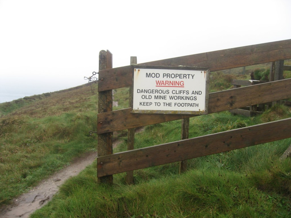
An unattractive MoD fence joined the landscape and stayed with us for the next hour.
At this stage the wind was strong but carrying fine rain. We enjoyed two very steep gullies, the second intriguingly named Sally’s Bottom. Sally Peters worked in the mines here and one of them was named Wheal Sally after her. It presumably followed that the steep valley below the mine was Sally’s Bottom.
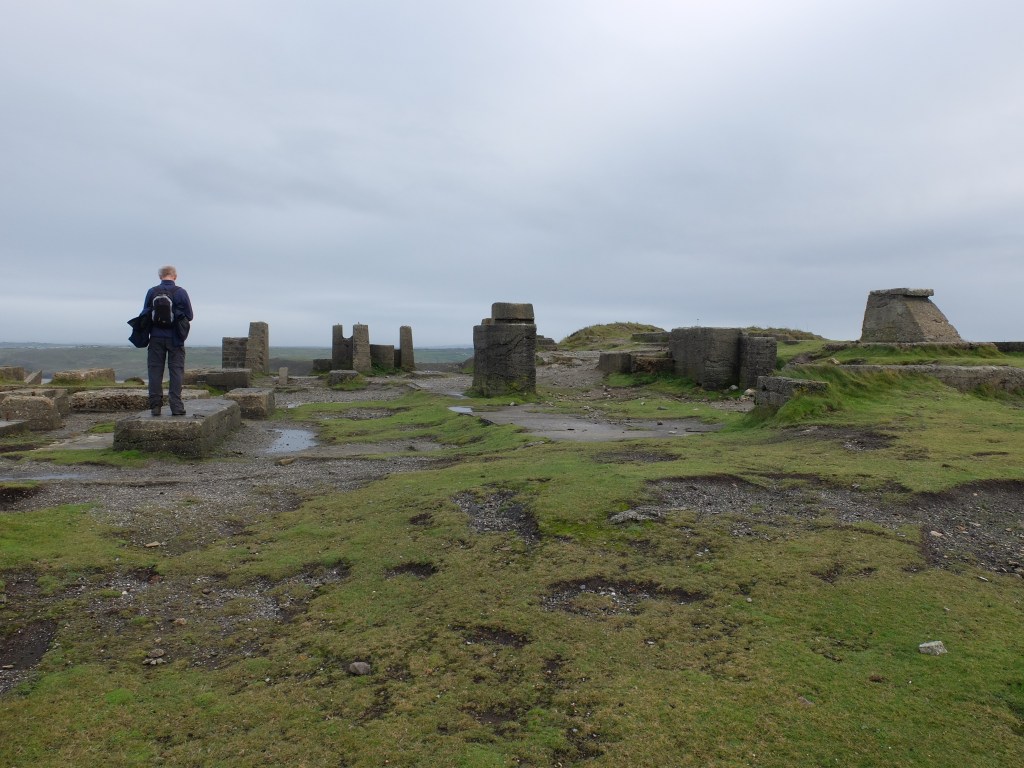
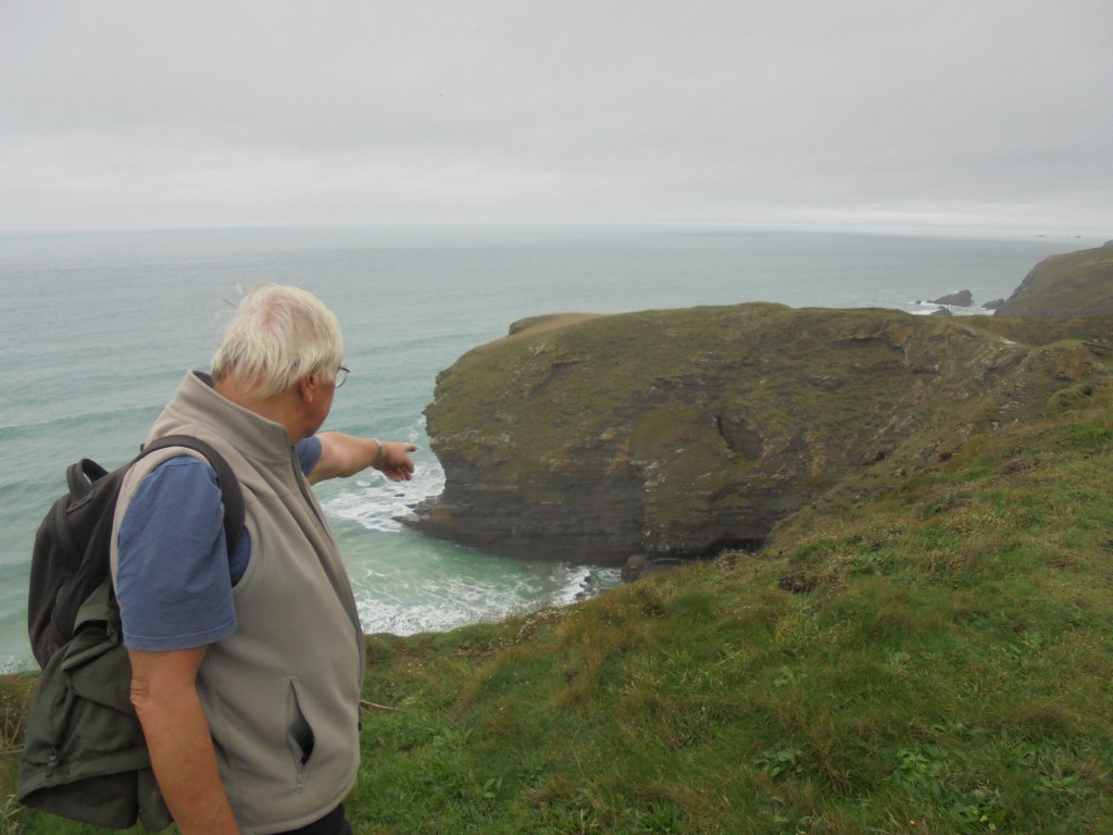
Above the valley we reached crude concrete shelters for the crews manning the guns guarding Portreath airfield during World War II. We said goodbye to the fence and were approaching Porthtowan. At the top of the hill a large heap of stone was being loaded into trucks and hauled away. A tall and lean builder called Andy walked out of the site on the way down the hill. We talked to him as we went. He was building some houses on the cliff road and having to haul the waste stone up the hill in dumptrucks. He also introduced us to geocaching, a more modern way of wandering the coastal path. Too late – we’re not going back to start again.
We wanted to get a picture of Andy but Richard’s camera decided it was too wet to function. Slowly the fine rain driven from the south-east had got heavier and the wind stronger. It was increasingly miserable.
Portwowan was about half way. Going through the town two large groups of walkers were assembling. At the top of the cliff we stopped briefly on a bench. In front of us a peregrine dived past in pursuit of a small bird and missed it. It climbed back for another attempt. It was a short moment but the speed and purpose of the dive was exciting.
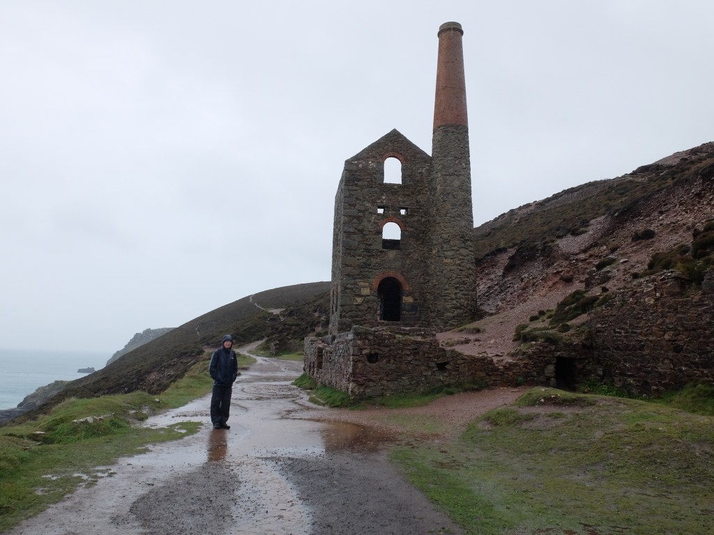
From here to St Agnes Head we mingled with the leading group of walkers, sometimes ahead sometimes behind. They had a very competent leader. We passed the well-preserved ruins of the Towanroath engine house.
The other walkers were ahead so we tagged along. Their leader was careful and, with the wind now blowing very strongly, would not let her fold near the edge at St Agnes Head. We followed gratefully. From the head we had a mile and a half to the town. At 1225 we dripped our way into the Driftwood Spars, wetter and colder than on any previous occasion. Wendy brought dry clothes and we gratefully changed and then enjoyed a slow pub lunch with the whole group.
Our walk had been shorter than originally planned – and quicker too. We set up a smart pace of 2.1 mph over the 8.4 miles. As on the previous day there was no incentive to stand and stare – or indeed take many photos. In the news that evening were reports of violent seas on the south coast, driven by the same winds that drenched us twenty or so miles to the north.
The next day was supposed to be Brexit day, no ifs no buts. The house was abuzz with politics, Brexit, Trump and related topics. Martin, who has a limited interest in government or being governed, found it hard to take.
There had of course been a number of ifs and buts, but our new leader was deft in moving on from his rock fast conviction. Bulldozers at Heathrow were similarly avoided. As if in relief at still being in the EU the weather had greatly improved.
Martin’s car had an appointment so we were down to two again. Climbing out of the cove we passed large slag heaps.

They made the landscape here but we were soon to be out of mining country.

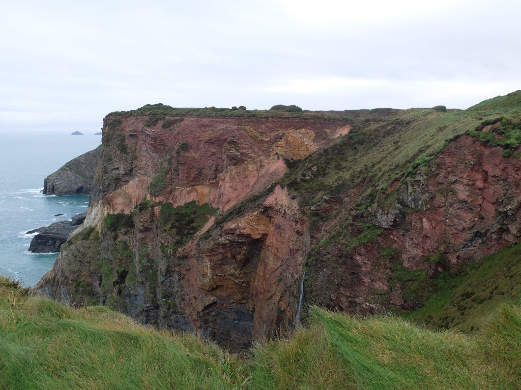
Around Pen a Gader there was a marked change in rock type with a colourful mix making up the cliff.
We were again walking alongside a clifftop airfield. The information on Portreath and Perranporth airfields was that they were fighter bases in World War II. This seemed a long way west to us. Looking in more detail they both had a varied role: fighters were stationed there and covered coastal and escort duties in the Channel as well as sweeps over France. Larger Coastal Command aircraft and air-sea rescue aircraft operated there. But Portreath also acted as a stopover for aircraft being flown to Africa and the Middle East and for US and Canadian aircraft.
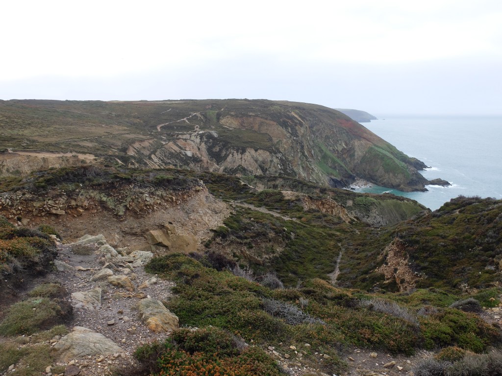
The impact of mining and airfields produced a confused landscape.
In many places the mine shafts are capped with a conical mesh hood developed in Wales.

We walked on through deep puddles. A raven croaked to encourage us. Our next stop was a more dramatic site at Cligga Head – an erstwhile dynamite factory whose last owner was the Nobel Company. The guide notes that there were “frequent explosions”. An explosion in 1902 shook windows in Truro 16 miles away.
The factory was only a temporary scar on the landscape.
Half an hour later we were coming down the path into Perranporth. The little black dots that looked initially like seals were actually surfers.

The sundial marked the start of the town and the edge of the beach that ran for two miles ahead of us.
Although the sundial was created as a millennial project it tells (pre-railway) Perranporth time rather than GMT and is therefore behind GMT. The difference varies according to source from 12 minutes to 20. One of them must be wrong. A quick and rather dilute hot chocolate at the Watering Hole gave us a small energy boost. We set off over a small dune ridge and then settled down to a long beach walk. There were hundreds of people on the beach but it is so vast at low water that it swallows them easily.

On our right the dune system was even higher than the towans near Hayle. The sand on the beach was firm and even, perfect for an easy walk. Just after midday we were off the beach and back on rocks. A short section round Penhale and Ligger Points showed us interesting rock caves and some triffids.

Disappointingly the triffids turned out to be mundane radio aerials. They are described coyly online as military installations, but their purpose is not described. We were due to meet Martin, Sally and Wendy at Holywell Bay. The timing was immaculate and they arrived just as we finished a quick lunch on a stone bench.
We were in dunes again for a short time and then heading for Kelsey Head.

On the way Martin spotted some snow buntings on a crumbling bit of cliff. His sense of risk vanished as it always does when he sees an exciting bird. There was much manoeuvring to get a better view, although oddly we did not end up with a photo. But we all saw four snow buntings which was a treat. Onwards to Kelsey Point. There on and around a rock called the Chick was a large group of seals. This was not on the scale of Mutton Cove but an interesting colony in rather wilder conditions.

After the seals Martin and Milo undertook a forensic review of the cliff edge while everyone else watched with apprehension. Eventually Sally managed to call them both to heel. From there it was an easy walk through Porth Joke cove to Crantock and thence back to our house.
In summer time there is a ferry crossing over the River Gannel from Crantock to Newquay. For our purposes Wendy was the ferry and took us round to Pentire Point. It was November 1st and the last day of our 2019 walking. This felt a bit timid compared with 2018 when we carried on walking into December. But we had a lot of good luck in 2019 so we were being prudent with it.
It was a breezy morning. On the beach at Crantock there was a continuous and distinct loud yapping from an out of control dog. We listened and concluded it was the same dog whose yapping had accompanied us all the way across Crantock Beach previous day. The owner was immediately and unanimously nominated for “Most selfish person in Cornwall 2019”. What is it about some dog owners that makes them feel immune from social rules?
Rounding Pentire it we could see why Newquay is the capital of Cornish surfing. Fistral Beach was brewing some small crests which were promising.

The path passes the Headlands Hotel, a red brick Victorian pile. In front of the hotel a pair of choughs was strolling in a proprietorial way.

Around the next corner was an older and more interesting building than the hotel – the huers’ hut. Thought to have been a 14th century hermitage it was taken over by pilchard fishers as their lookout point. The huers would watch out for shoals and raise the cry when they saw them. The boats would set out as soon as the cry was raised. We had a debate about two parts of this. The first was the cry used: on the south coast they seem to have shouted “heva, heva”. Martin seemed to think the cry here was different, more like “huer, huer”. The second interesting issue was how the huer managed to direct his friends without giving the game away to opposition boats. Apparently he would have used gorse branches with rags attached to operate a private semaphore, akin to the tic-tacs on race courses. But it’s surprising that the opposition boats didn’t rumble the code fairly quickly. The debate was lively with no firm conclusions.

Coming down from the huers’ hut we passed the attractive little harbour and came to the house on the island rock. This is connected to the mainland with an attractive steel suspension bridge. It looks an idyllic spot until you start to think about the practicalities of living there.

From there the path cut back into the town on the former tramway. The position of the rails was marked out with darker stone. Newquay centre feels in transition. There are a lot of hotels being knocked down and redeveloped. The town is less attractive than its coast.

We passed the small cove known as Lusty Glaze. The northern end of Newquay is marked by Porth Beach. This is another deceptive river entrance. The guide implied that we could cross the beach and the river without going round the top. This turned out be untrue. As Dugald had confidently advocated this route, Martin pointed out that it was wrong. Dugald agreed the route was flawed, but Martin wanted a clearer acknowledgement that it was wrong. After some debate this was clearly recorded – Dugald was wrong (unusual?). We walked round the top.

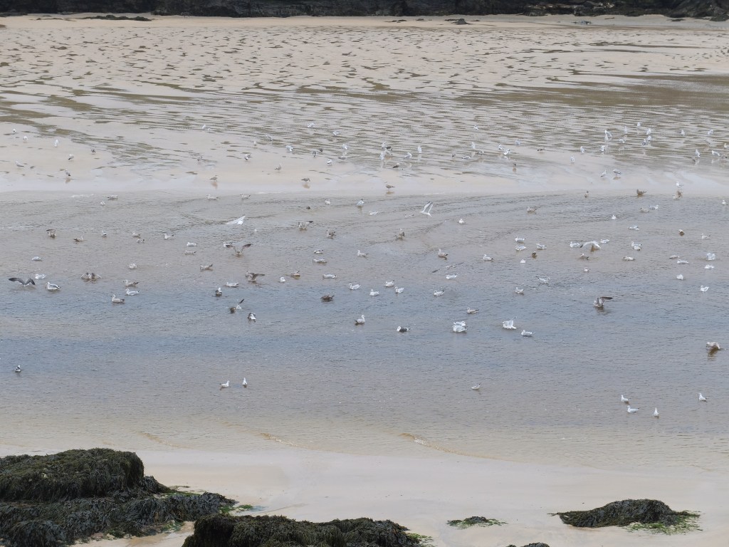
Hosts of birds were enjoying the beach at low water.
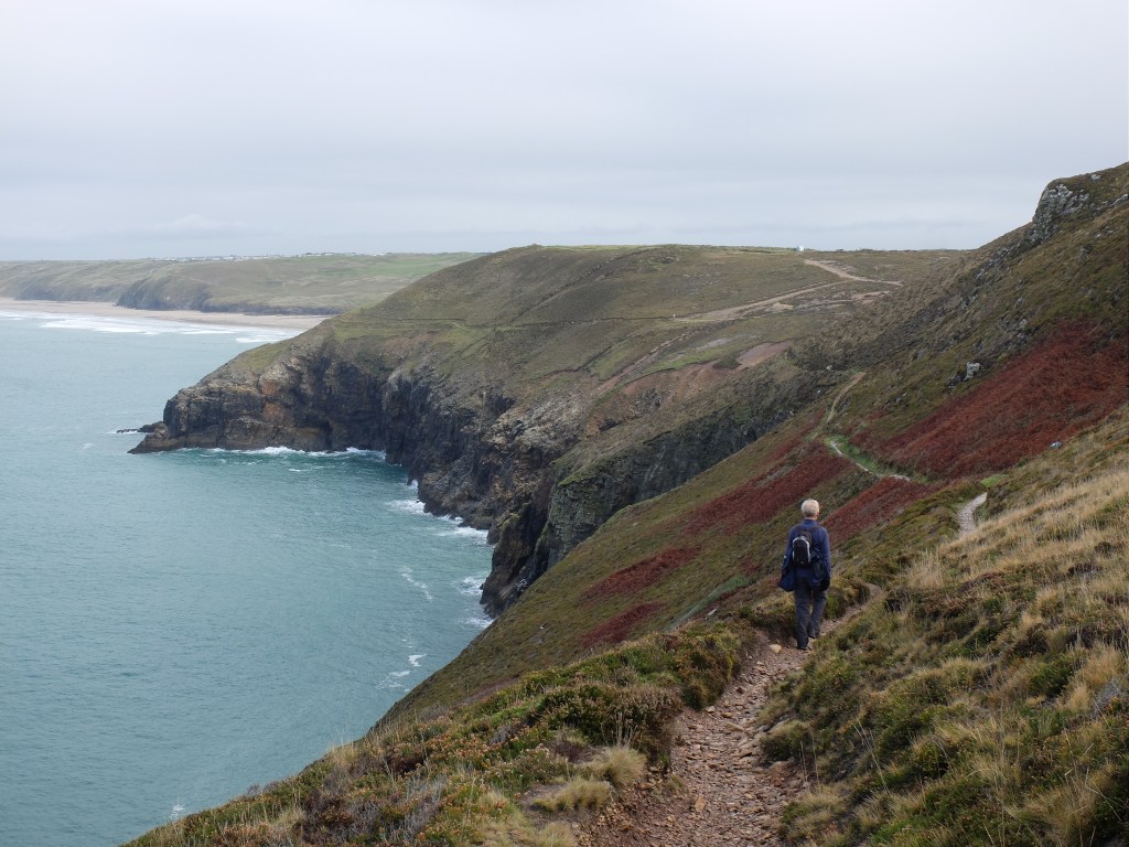
Trevelgue Head is the site of an Iron Age fort. Beyond it were the beaches of Watergate Bay, the last long stretch of sand in 2019. The sun came out briefly and lit up the view back to Newquay.
Looking inland the view was suddenly very different from what we’d become used to. The rocky terrain with its old mines was gone and a greener softer landscape with large fields had replaced it. We were heading away from the toughest land of Cornwall back to the more comfortable and effete parts of England. The cliff walk was easy except for a sharp descent to the Whitegate Hotel. Here Richard and Martin were offered a decent cup of coffee. They spurned it in favour of a long grind up the hill and a break for water and instant coffee at the top.
Because the forecast was for heavy rain at 1.0 pm our destination was Mawgan Porth. As we headed for it the clouds and rain began to gather behind us.
Before we got to the end there was one other sight to admire. Leaving Watergate Beach we rounded Stem Point and arrived at Stem Cove. This had a special significance for Martin because it was the home of the last pair of indigenous choughs in Cornwall. The last one died in 1973 and Martin had been up to the cove to see it then, but too late. After a failed plan to reintroduce them a small group of choughs, no more than five, arrived from Ireland and established a colony in 2001. From them comes the current chough population in Cornwall.
An energetic climb followed Stem Cove and then a last descent into Mawgan Porth. We arrived at the Merry Moor Inn and found a comfortable berth. Five minutes later the skies opened and rain poured down. This was better timing than we’d managed earlier in the week.
Given the weather that followed in early November our decision to finish on 1 November looked good too. In spite of difficult weather we achieved nearly 60 miles in our week’s walking. We have about 184 miles left to Minehead, so have done over 70% of the walk.
We have had four weeks in Cornwall in 2019 and enjoyed them all. We all know and appreciate the county more than we did. We’ve seen and experienced its different views and moods. Now it was time for the team to pack up for the winter and go home to the joys of the general election.