For the last fifty miles or so of our walking cirl buntings have been the ghosts at the party – invited but never present. At the end of October they decided it was time to talk to Martin after all and they feted him throughout the walk.
Our journey was from one great sailing river to another – from Dartmouth to Salcombe. The forecast was for the warm weather to end with a crash in temperature on Friday 26th so the choice of 24th and 25th was a good one. Early signs of winter did indeed arrive on the Friday.
Parking is a problem in Dartmouth, but eventually we found a space in a road high above the town. As we set off the main building of Britannia Royal Naval College peeped over the brow. The building dates from 1905 although training of naval officers had taken place in the town and on the river since 1863. The architect was Aston Webb who was also responsible for the current façade of Buckingham Palace which was installed in three short months in the summer of 1913. The college is a reminder of the glory days of the Royal Navy.

Down by the river the town was half term busy with lots of grandparents shepherding grandchildren in the bright sunshine. Dominating the river was a large superyacht Cloudbreak. Not the largest of the breed but nevertheless an expensive beast. She may have been on a charter for a well-heeled half term break; but perhaps her owner was on board. The website of the yard Abeking-Rasmussen tells us breathlessly that the owner is a sensitive Nordic man. Apparently the layout allows the owner to walk from the gym to his cabin without exposing his sweating body to guests in the saloon. That’s a relief – imagine the trauma for both parties if this happened.

Ordinary people contented themselves with the very pleasant autumn scene, and some of them got a close view of Cloudbreak from a trip boat. As we climbed out of the town we had a view of a train of the Dartmouth Steam Railway pulling away from Kingswear, which would have been a familiar route to many of the College’s cadets in the past.

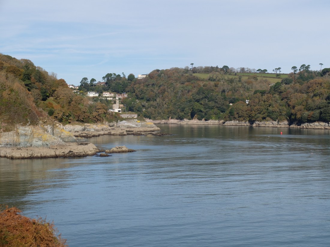
Just after midday we could see the mouth of the estuary opening out into an attractive scene. Martin reminded us that the Dart is not a river estuary, but a ria. Rias, like cirl buntings, are things of which we were blissfully ignorant until Martin told us about them. These walks are an education. In short a ria is a river valley that has been flooded by a rise in sea level.
On we went musing about rias, now heading West on a pleasant easy path. Just above Combe Point we saw a sparrowhawk “on soar”: it was not hunting, just enjoying the glory of soaring on a beautiful day. If only we could too. An attractive bench meant lunch came early.

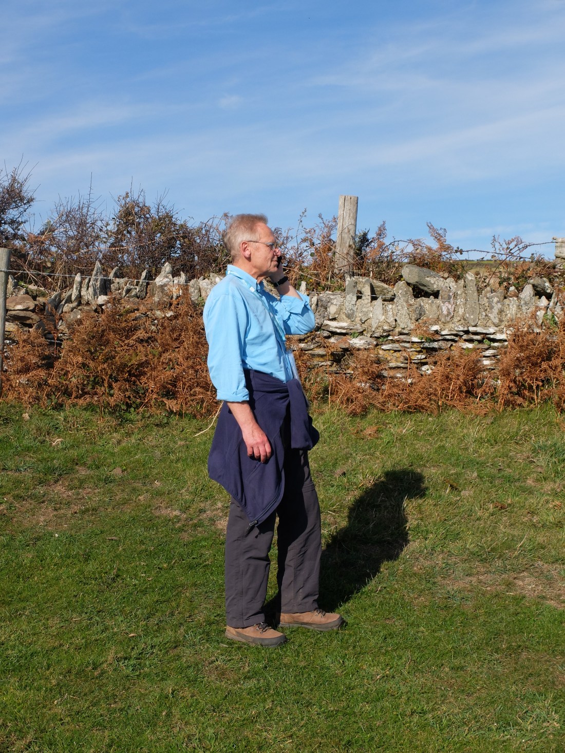
In the middle of our coastal lunch Richard got a business call and became very serious. He’s meant to be leaving it all behind and we may need to think of confiscating his phone.
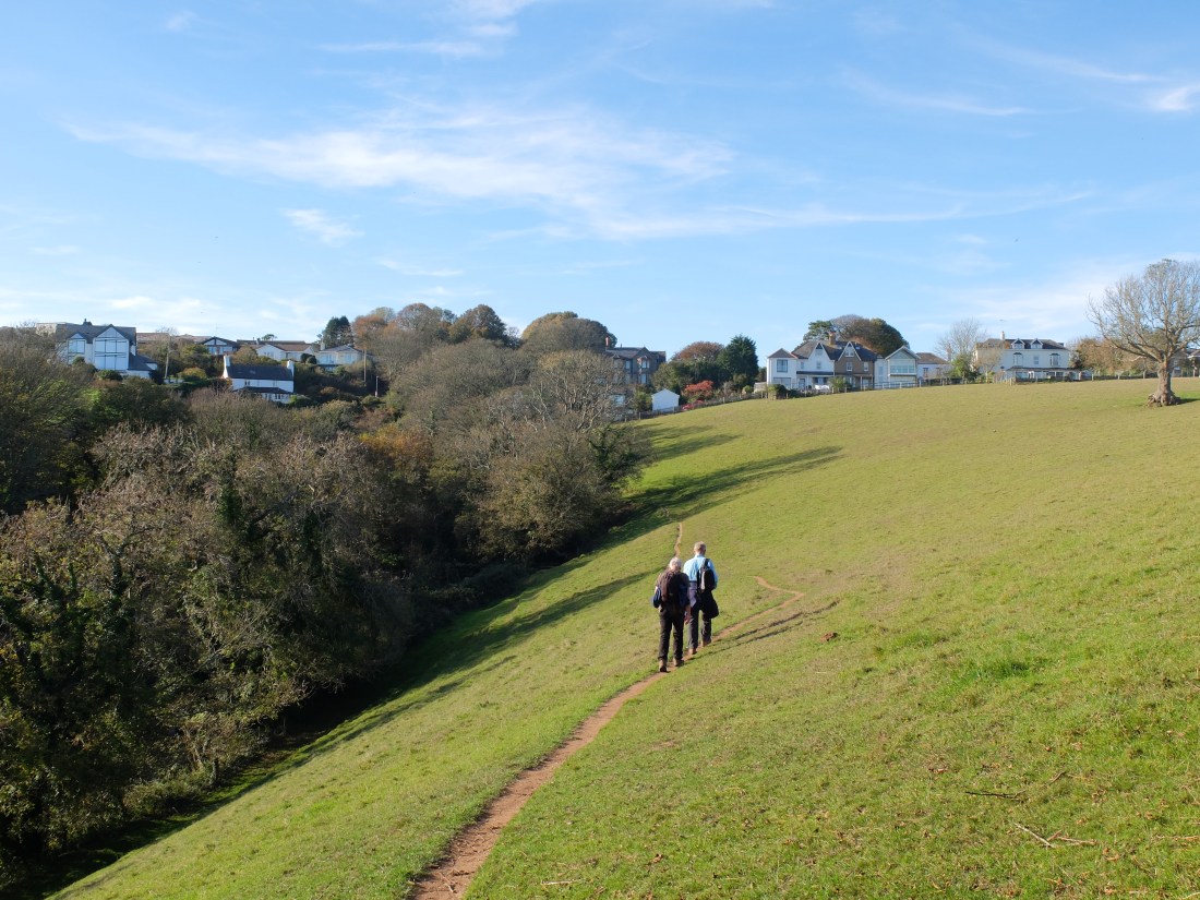
At Warren Cove we had to turn inland to go round private land belonging to Redlap House. A long road section took us through Stoke Fleming and eventually onto a path above Blackpool Sands.

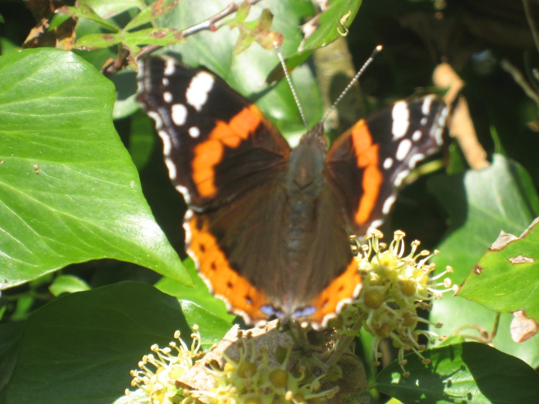
We briefly got lost here but with an unexpected result. As we got back on course we saw a cirl bunting sitting on a telephone wire. This was a moment of great triumph, a sighting after all the talk. Richard captured the bird on its rather mundane phone line. Martin was ecstatic and those who doubted him could now see the evidence. We heard further calls during the afternoon.

The cirl bunting is closely related and similar-looking to the Yellowhammer, but it is only found in the UK along the coastal fringe of South Devon/Cornwall. There are only a few hundred pairs and countryside management schemes help maintain the population. This image from the internet gives a bit more detail.

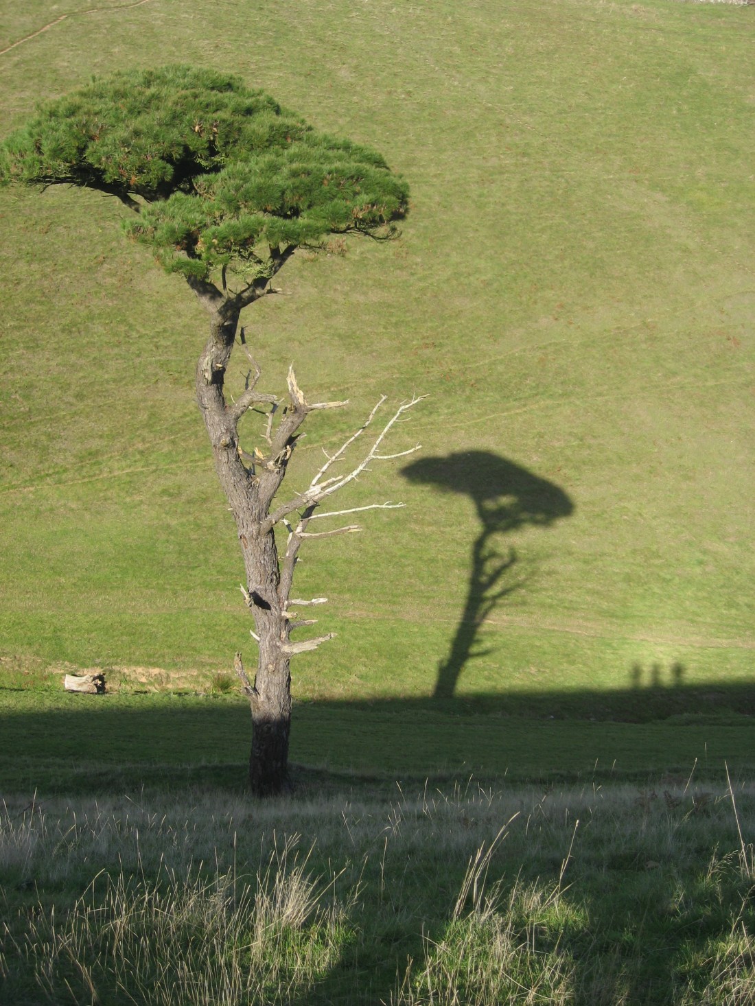
The climbs had been mild but just after our cirl bunting encounter we went up and down a very steep little valley above Landcombe Cove. The art work “Three Walkers and a Tree” is dedicated to this climb.
Not long after we could see the shape of Slapton Sands and Torcross.
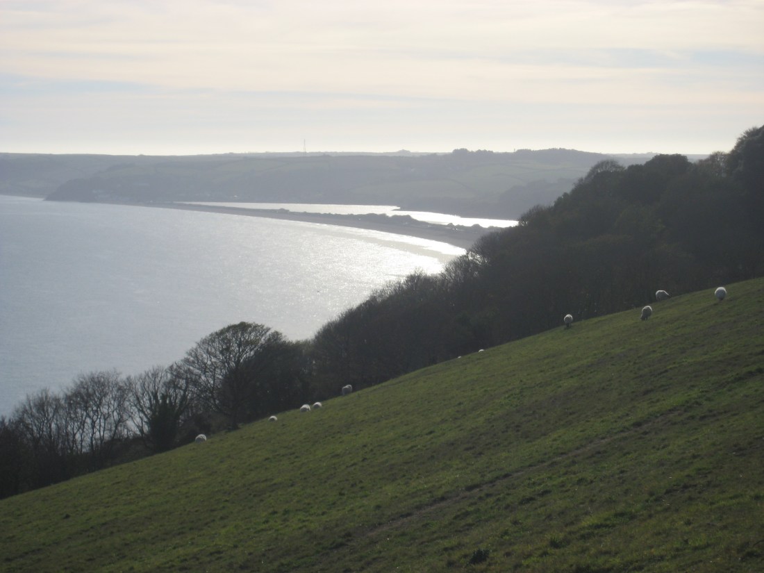
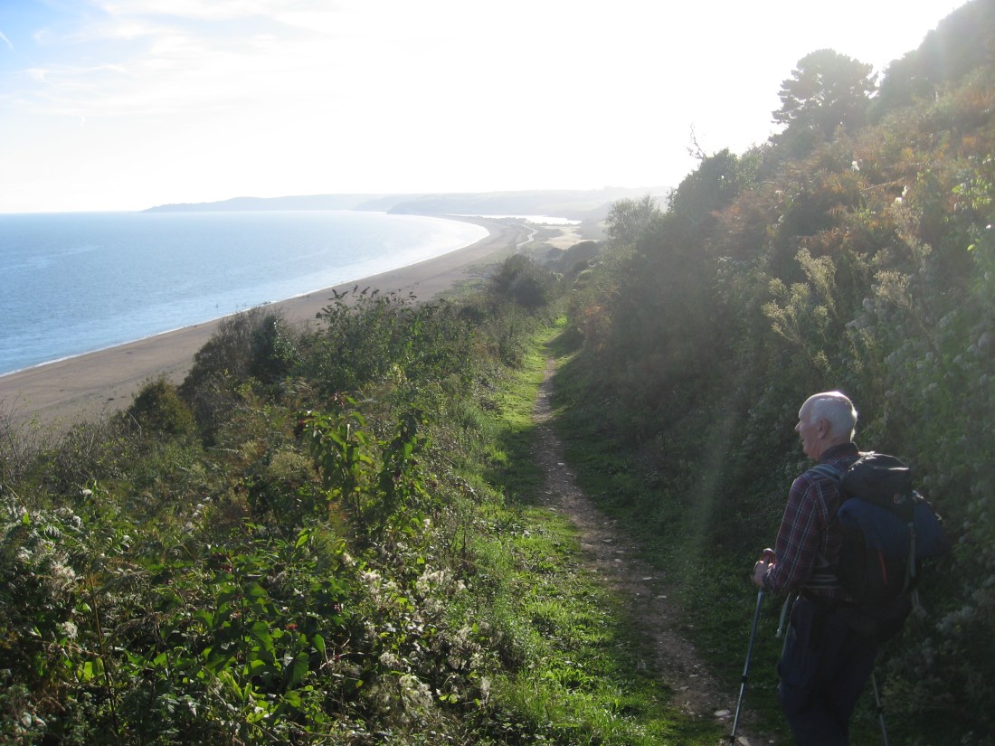
As ever getting there was less simple than the view. But by four o’ clock we were on the path along Slapton Sands. Half term paddle boarders went quietly by. It was a pleasant view but almost immediately we were diverted across the road to a path behind the road and the bank – with no view. The road had just been reopened after repairs to a long stretch damaged by storms in the spring.

The new “path” had been cut through blackthorn which did its utmost to trick and trip three weary walkers. On our right the waters of the Higher Ley were hidden by reeds. Half way down we diverted up the road to Slapton to look at the bridge over the leys where Martin and Sally used to watch otters in the ‘70s. The scene is the same, but a bit more choked with brambles than then; and they are still besotted with otters.
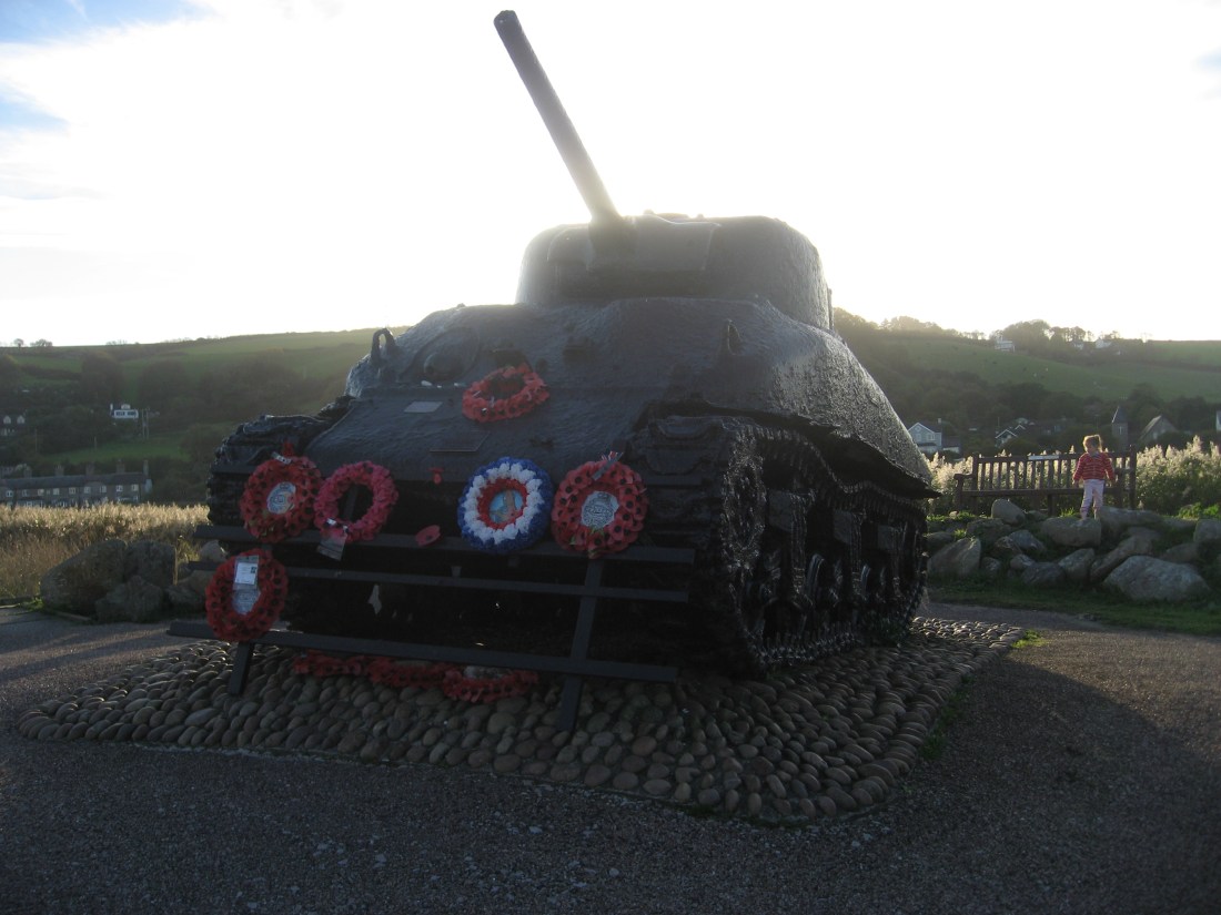
Just before we got to Torcross we looked at the memorial erected by the US Army to thank local people for leaving their homes, farms and businesses to allow D-Day rehearsals to take place.
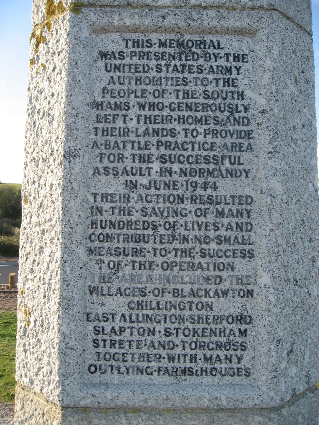
Sadly one of the exercises was interrupted by a daring attack by German E-boats which resulted in the death of over seven hundred American servicemen. One of the Sherman tanks that was lost in the attack was rescued from the bay in 1984 by a local man, Ken Small, and remains as a memorial to those who lost their lives.
We had reached Torcross and there to greet us was Kathryn our Airbnb host. She had a large ice-cream in hand to fortify her for our arrival. She told us she never normally bought ice creams so this may be the start of a steep and slippery slope!

Ice cream finished Kathryn whisked us off to West Alvington for a very comfortable night in her house. On the way round to Kingsbridge she described the estuary as a ria which was the cue for another ria discussion. Apparently the Salcombe-Kingsbridge estuary is an extreme example of a ria because there is no significant river feeding it. There is one unresolved ria issue: it is said that a characteristic feature of a ria is that trees grow right down to the water’s edge. That is certainly the case in the Fal and the Dart, but is hard to see why this should be a distinctive feature: the valleys were flooded thousands of years ago, whereas the trees are perhaps two hundred years old. How do the trees know what is expected of them? A puzzle – with a prize of a pint of London Pride for the first credible answer.
Kathryn looked after us very well (her link is http://www.airbnb.co.uk/rooms/23962141). We ate at the local pub, too tired to trek down into the town and back again. We slept like logs. In the morning we had a superb cooked breakfast and Kathryn kindly took us back to Torcross. At half past eight the air temperature was 6 degrees. Two hardy swimmers were enjoying a dip in the bay.
With 13 miles to go we needed to get moving. A false start led us to a dead end on the beach and to a climb out over storm rubble to the real path. Just after nine we were standing on a bluff with a great view of Start Point and Martin had seen another cirl bunting. Soon after Widdicombe Ley was hosting a large number of swans and some good flypasts too. Martin counted sixty on the water.

With the encouragement of another cirl bunting we got to Hallsands, the site of a village lost to the sea as a result of human interference. At the end of the nineteenth century over 600,000 tons of shingle had been taken from further up the coast for extending Plymouth dockyard. As a result the bank defending Hallsands was weakened and the village was swept away in a storm in January 1917.


Just beyond the site of the old village we walked through a grove of cherry trees and then a line of apple which must have been orchards for the old houses. Start Point slowly approached us.

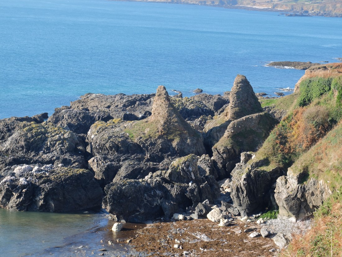
By 11.00 we had passed Start Point and were soon able to settle on a nice bench above Peartree Cove. One of the features of this part of the coast is a lot of very small beaches with difficult paths as access – great for landing off boats and not crowded. Further round the bay two strange stone knolls were masquerading as antediluvian walruses.
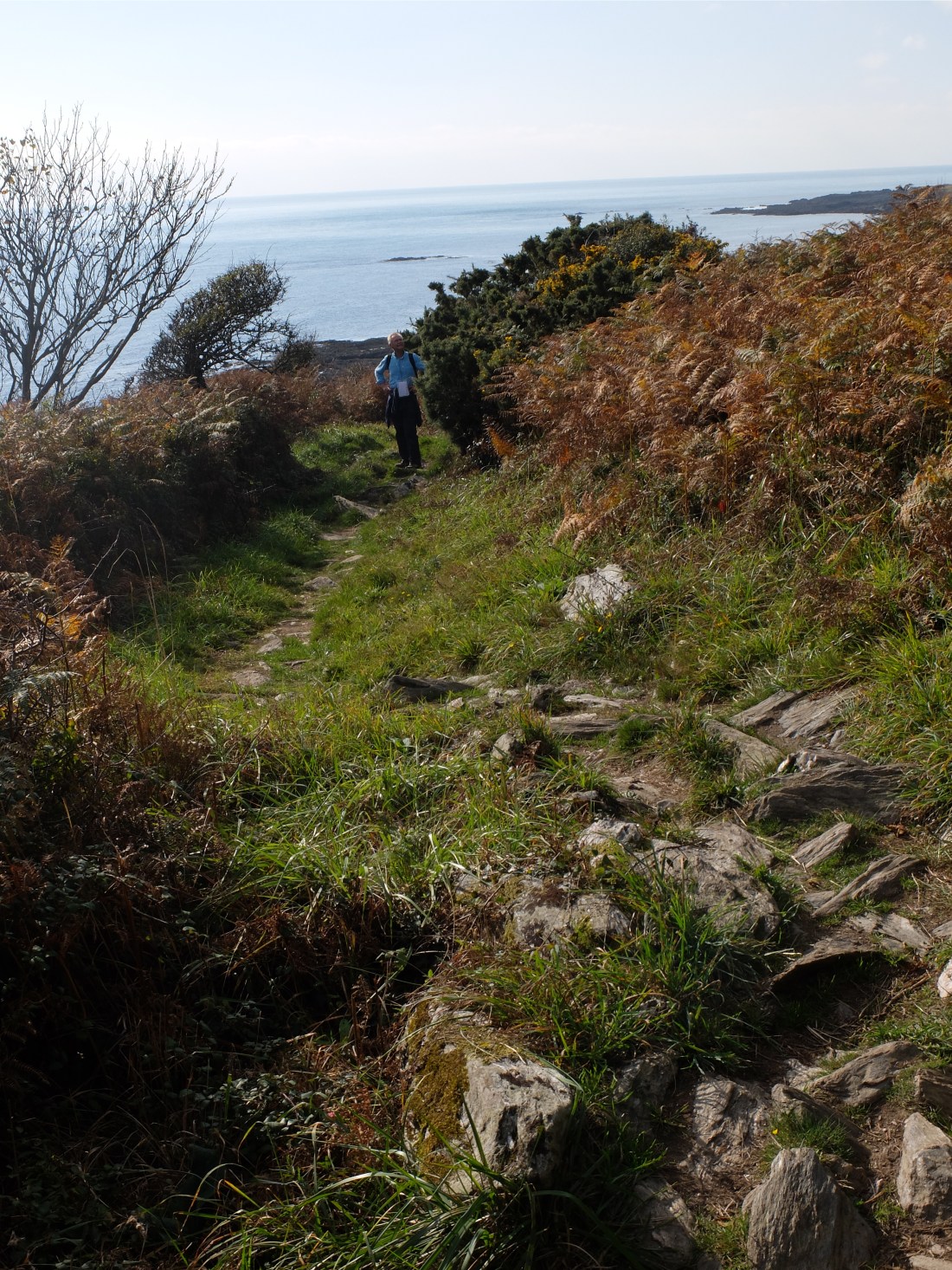
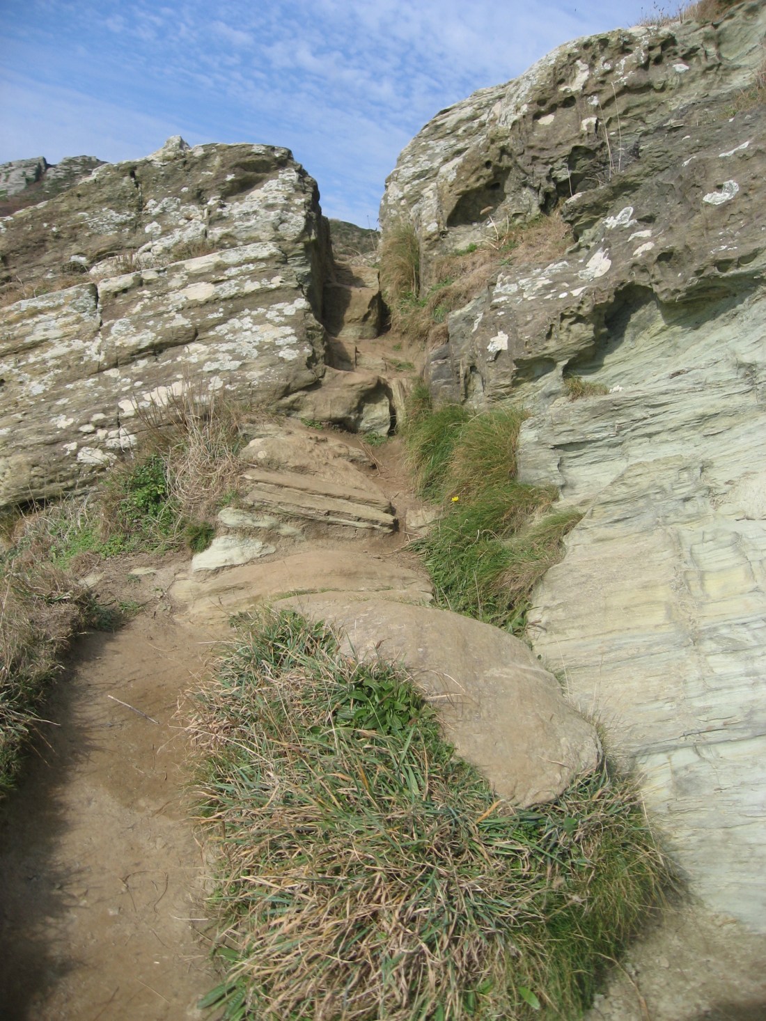
And then we discovered why this section is rated as strenuous as we picked our way over the worst bit of the path so far. The surface is littered with petrified rocks lying in the same formation as they fell into millions of years ago and not of course designed to be convenient to humans. They were not. It took just over an hour to get through, but every step was a possible twisted/broken ankle. A steep grass hill would have been a joy by comparison.
But effort has its reward. In a couple of small trees was a cirl bunting convention. There must have been ten of them and perhaps more. We were able to stand and watch these bird icons before dragging Martin away after about twenty minutes. He had always said that Prawle Point was Cirl Bunting Central and we weren’t far away.
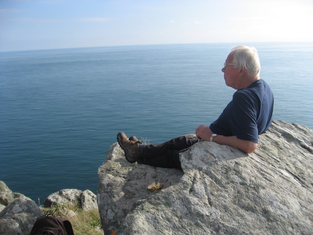
We reached Prawle Point where volunteers of the National Coastwatch Institution look out over the Channel. The visitors’ centre is excellent – informative, fresh and well laid out. It has of course a cirl bunting section. Lunch followed and Martin was at ease in his rock armchair.
We left Prawle Point at 2.00 and met some more petrified rock on our last stretch.
But it wasn’t long before the estuary (ria?) began to open up. A very welcome sign followed.

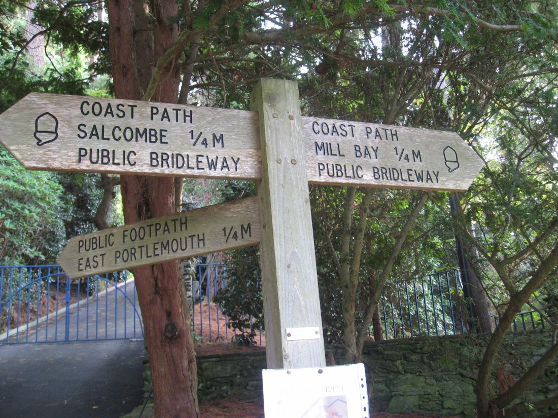
The last stretch to the ferry was through some of Salcombe’s most affluent streets. Three scruffy walkers looked out of place. But they were very happy to step onto the ferry which sped them across to the main town.


From there a very comfortable taxi driven by Mike from Coast-to-Coast took us back to Dartmouth and the car.
We walked in the last two warm days of October, met numerous cirl buntings, learned new things, had a generous and kind host for our stayover and achieved our twenty three miles. What more could we ask?