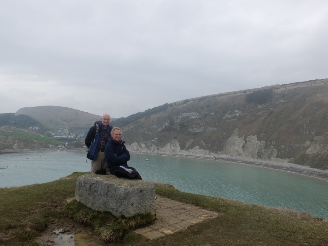
Our walking weekends have neatly bracketed the arrival and departure of the Beast and the Mini-Beast, although the Micro-Beast still looks possible for Easter. Martin had done some reconnaissance on the Friday and declared the going better than expected in spite of all the melted snow. It then rained hard all night, but even after that it was much drier than expected. True some tough and resilient little blocks of snow still lurked under hedges and in corners. But for most of our March walk we were on closely grazed and springy turf.
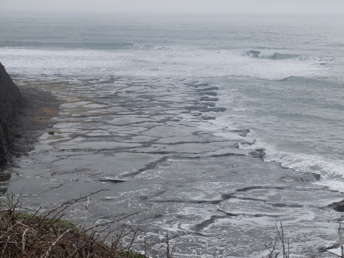
When we arrived at Kimmeridge we found a crowd of enthusiastic and committed surfers. The tide and the wind must have been right and social media buzzing, because they were all there. It was quite a shortlived swell because half an hour after we had left the best surf had retreated from the main beach to the wings of the bay.

Just after 11.00 we passed the Kimmeridge oilwell with its slowly nodding donkey which has been pumping about eighty barrels a day since 1959. It must have been a bad day for OPEC when the pump started.
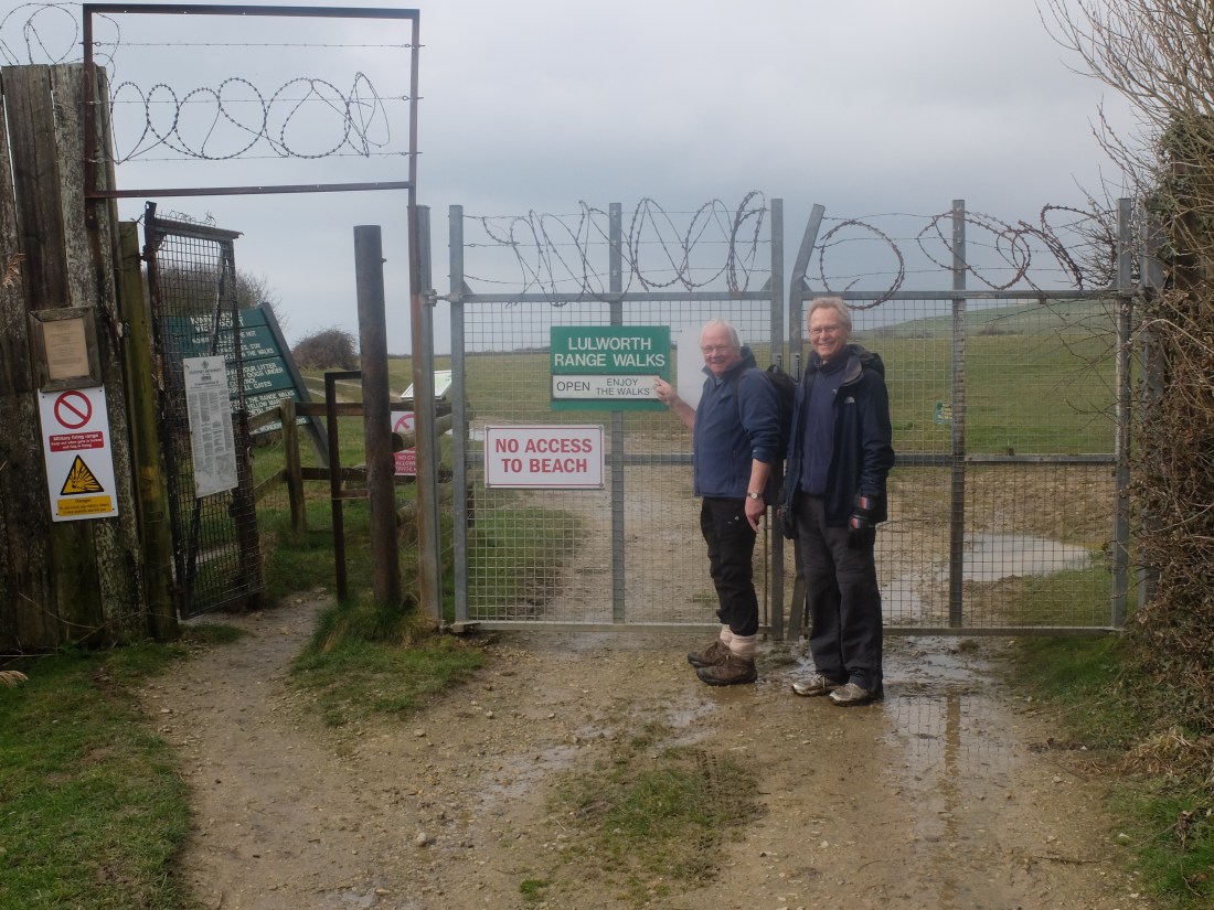
Soon after we were through a starkly barbed gate on to the Lulworth range path.
Half an hour later a raven flew past in a close encounter. We suspect that this is a friend of Martin’s which has agreed to have an implant and fly to demand. Too close for coincidence, but Martin denied it vehemently. A bit later we watched a raven – not Martin’s friend – being mobbed by two crows.
On both sides of the path were thick clumps of tough grass Martin identified as Tor Grass. These tufts provide a home for the Lulworth Skipper caterpillar and later butterfly. Apparently this is the only butterfly in the UK to be named after its place of origin. Dugald felt sure that this was the self-same grass that had cluttered up the water meadows at Bearley, but Martin dissented. Question for Google resolution.

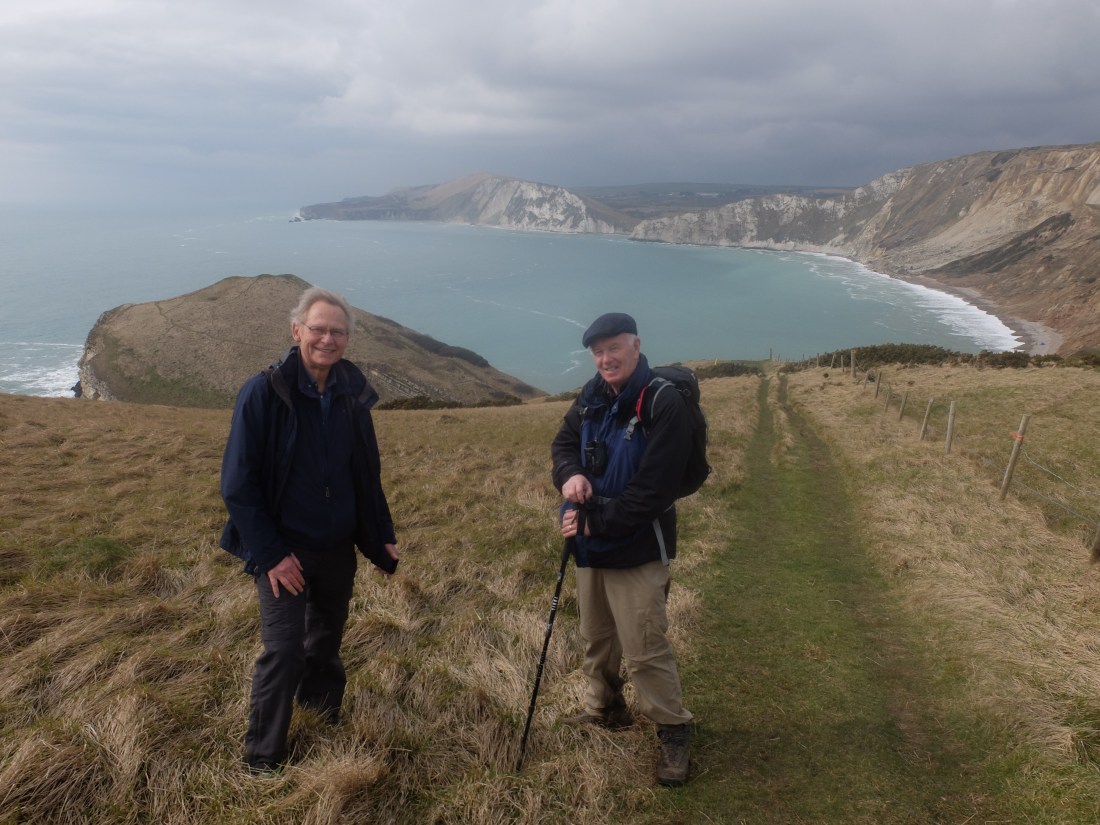
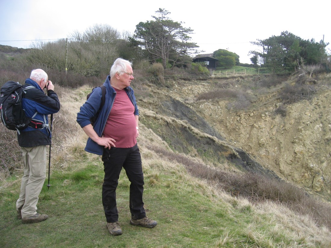
All this admiration of nature was interrupted by a steep climb up to the top of Gad Cliff. This was a new experience with a savage slope for what felt like several hundred feet. Looking at the contours which are densely packed it looks as though the actual height was just over 500 feet. The reward at the top was a wonderful view in both directions. The guide helpfully rated this as a three arrow climb.
By midday we were due South of Tyneham village, evacuated for D-Day preparations and then never returned to its residents. A convenient and well situated place for tank and other training, but a shabby abuse of power by government. The empty and mainly roofless buildings are witness to their history and add to the eerie atmosphere of the ranges.

Some of this is because the area is not cultivated, but what makes it surreal is the carcasses of dead or perhaps bogus tanks nestled in the grass. Their camouflage is very effective so they are not immediately obvious.
Going down to Worborrow Tout was steep and a three arrow slope.
A line of tank traps leads into the natural stratum of the Tout in an interesting combination.

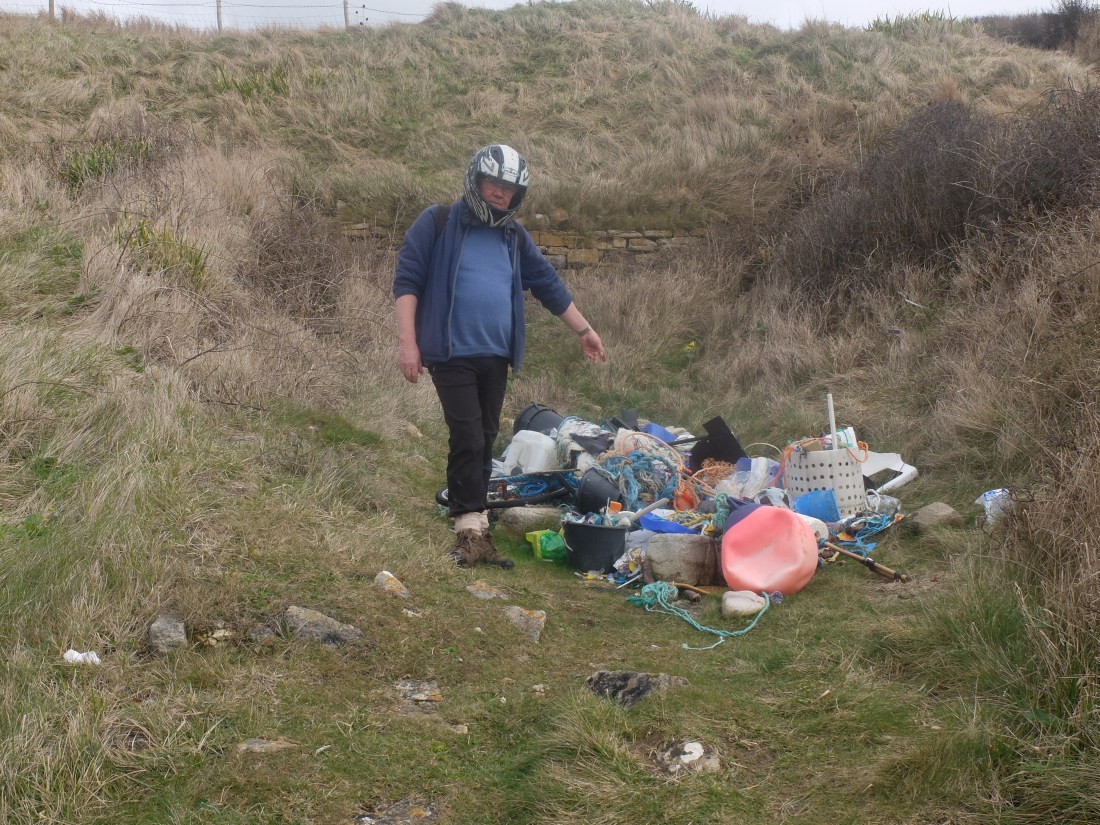
But Martin’s discovery of a plastic dump promised more immediate playthings.
The slope up was also a three arrow and longer than before, but with the Flower’s Barrow and the reward of lunch at the end. From our height we watched a skylark at close quarters as it hovered above its territory below.

Very steep alternated with fairly level as we headed West.

Towards the end of the range we passed through a scorched area of the path. Below it was an assortment of twisted metal shards. We assumed these to be the debris of small arms because otherwise the cliff would have blown into the sea; but it did show beyond doubt that this was an active practice area. Lower down the hill a network of rails must be for moving targets.
We were nearing Lulworth and by half past three could see the village. After a quick inspection of the Fossil Forest and some entertainment at the picture of a man shaking a spear at a dinosaur, we were down on the beach and tramping the shingle. At half past four we were in the Lulworth Cove Inn and beer never tasted better.

The next day was the first day of summer time, so three optimistic walkers set out from Lulworth up a long set of 333 stone steps.

There were more people around than the previous day, perhaps because this was the path to Durdle Door.
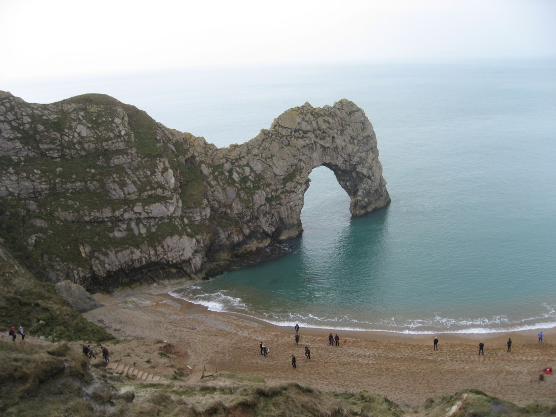
At the top of the steps was a group of young Chinese tourists who had brought their tame drone with them to record every detail. It made an infuriating buzzing noise that disturbed the peace. A shotgun must be the weapon of choice for dealing with drones. Fortunately for the drone and its owners they were not going far. But it prompted thoughts about what our lives will be like as drones scuttle to and forth on thousands of daily errands. Perhaps we will remember the sound of a single 747 arriving at Heathrow with nostalgic affection. Richard had not seen Durdle Door before so we went down the bottom path to view it.

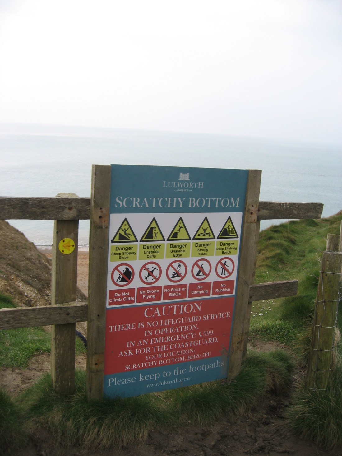
The crowds thinned out here as we headed upwards from the intriguingly named Scratchy Bottom.
Progress was wetter than the previous day, but with the compensation that the rises and falls were much milder. No three arrow climbs here. On the top of the down we arrived at a beacon at West Bottom.
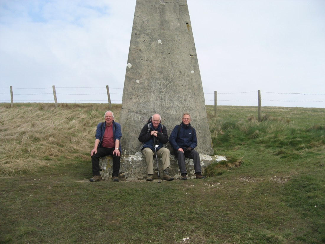
An obelisk with a sharply pointed top it had nothing to explain its presence. Cue a discussion between the three of us and a young couple about its purpose. Dugald came up with an elaborate theory that it was to enable ships to swing their compasses. Nobody disagreed but Google in due course came up with a more mundane navigation mark explanation.
Lunch was planned for Ringstead Bay and we came downhill past the Burning Cliff where there had been a very recent slip.
In 1826 a similar slip precipitated a fire in the oil shale that burned for four years. Looking back we could see the profile of the White Nothe and understand its name for the first time: a powerful Roman Nose projects into the sea with a large scooped eye socket at its top.
Close to the beach we met a pack of beagles – 25 couples of eager little hounds running around; but to what purpose?

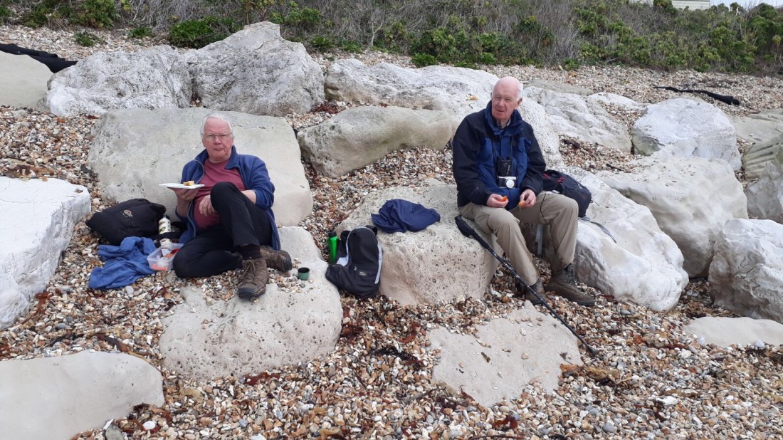
We were not sure whether beagles now hunt drags or just run around. We sat on large smooth rocks on Ringstead beach and Dugald reminisced about sailing with Philip Mangnall here in the early ‘seventies.
The slipway today is covered with deep shingle so the launch would be much trickier than then.
After lunch the going got progressively muddier and more difficult.
The path through thorns is a trough of mud a foot wide with the sides sloping at 45 degrees on either side and very slippery. The options are therefore to wade through the mud or slither around on the banks. Richard was wearing new boots in the vain hope that their smart brown leather would still be pristine at the end of the day. The pub at Osmington Mills looked very attractive but we bravely passed it by and kept going. After two miles of sliding and slithering we saw Sally, Martin’s wife, in the distance: we were thrilled to see her.

This was our best day so far with nine miles covered but hopes of averaging ten miles per day seem some way off.
During the day we had a debate about whether you have to go round Portland in order to complete the Coast Path. Eventually we decided it was cheating to miss Portland out. Martin, being a local, exempted himself from the Portland section. He had already told us about a vertiginous section on the cliff at Portland: this coming from a man who delights in dancing along the edge of the cliff makes it particularly frightening. We agreed we would do the island in the hope that Martin will periodically turn up with a silver tray with two large gin and tonics on it. The thought sustains us in our planning.
